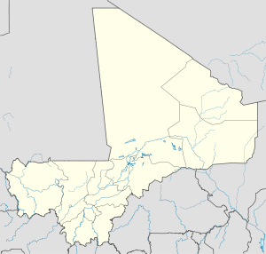
Kita, Mali
| Kita | |
|---|---|
| Commune and town | |
 Kita | |
| Coordinates: 13°2′20″N 9°29′15″W / 13.03889°N 9.48750°WCoordinates: 13°2′20″N 9°29′15″W / 13.03889°N 9.48750°W | |
| Country |
|
| Region | Kayes Region |
| Cercle | Kita Cercle |
| Elevation | 332 m (1,089 ft) |
| Population (2009 census)[1] | |
| • Total | 48,957 |
Kita is a town and urban commune in western Mali. The town is the capital of the Kita Cercle in the Kayes Region. It lies on the eastern slope of Mount Kita (Bambara: "Kita-kulu"), known for its caves and rock paintings. Today, the town is known for its music, its annual Roman Catholic pilgrimage and its role as a processing center for the surrounding cotton- and peanut-growing region. Kita lies on the Dakar-Niger Railway and is the largest transit hub between Bamako (112 miles) and Kayes (205 miles). In the 2009 census the urban commune had a population of 48,947.[1]
In November 1955, Kita became a commune of average exercise. On March 2, 1966, Kita became a commune of full exercise. The town grew in the 1990s around the cotton industry, but this has since declined.
A fictionalized version of Kita features as the setting for Malian author Massa Makan Diabaté's "Kouta Trilogy" (Le lieutenant de Kouta, Le coiffeur de Kouta, and Le boucher de Kouta).[2]
Notable residents
- Djelimady Tounkara, musician and one of the foremost guitarists in Africa.
- Cheick Hamala Diabate, Griot and Afropop musician
- Kandia Kouyaté, musician
- Massa Makan Diabaté
See also
References
- ↑ 1.0 1.1 Resultats Provisoires RGPH 2009 (Région de Kayes) (in French), République de Mali: Institut National de la Statistique.
- ↑ Drame, Kandioura. "Diabaté, Massa Makan." The Encyclopedia of African Literatures. Ed. Simon Gikandi. p. 195.
External links
- Plan de Sécurité Alimentaire Commune Urbaine de Kita 2007-2011 (in French), Commissariat à la Sécurité Alimentaire, République du Mali, USAID-Mali, 2006.
