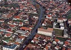
Kiskunmajsa
From Wikipedia, the free encyclopedia
| Kiskunmajsa | ||
|---|---|---|
 | ||
| ||
 Kiskunmajsa | ||
| Coordinates: 46°29′32″N 19°44′13″E / 46.49231°N 19.73683°ECoordinates: 46°29′32″N 19°44′13″E / 46.49231°N 19.73683°E | ||
| Country |
| |
| County | Bács-Kiskun | |
| Area | ||
| • Total | 221.99 km2 (85.71 sq mi) | |
| Population (2009) | ||
| • Total | 11,707 | |
| • Density | 53.5/km2 (139/sq mi) | |
| Time zone | CET (UTC+1) | |
| • Summer (DST) | CEST (UTC+2) | |
| Postal code | 6120 | |
| Area code(s) | 77 | |
| Website | http://kiskunmajsa.hu/ | |
Kiskunmajsa is a town in Bács-Kiskun county, Hungary.
International relations
Twin towns — Sister cities
Kiskunmajsa is twinned with:
-
 Bačka Topola, Serbia
 -
 Gheorgheni, Romania
-
 Lommatzsch, Germany
 -
 Bad Schönborn, Germany
 -
 Lubliniec, Poland
Gallery
| Wikimedia Commons has media related to Kiskunmajsa. |
This article is issued from Wikipedia. The text is available under the Creative Commons Attribution/Share Alike; additional terms may apply for the media files.


