Kirchsahr
From Wikipedia, the free encyclopedia
| Kirchsahr | ||
|---|---|---|
| ||
 Kirchsahr | ||
Location of Kirchsahr within Ahrweiler district 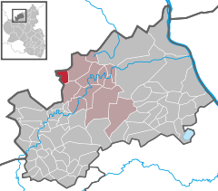
 | ||
| Coordinates: 50°31′28″N 06°53′54″E / 50.52444°N 6.89833°ECoordinates: 50°31′28″N 06°53′54″E / 50.52444°N 6.89833°E | ||
| Country | Germany | |
| State | Rhineland-Palatinate | |
| District | Ahrweiler | |
| Municipal assoc. | Altenahr | |
| Subdivisions | 5 | |
| Government | ||
| • Mayor | Stefan Reitler | |
| Area | ||
| • Total | 6.11 km2 (2.36 sq mi) | |
| Elevation | 288 m (945 ft) | |
| Population (2012-12-31)[1] | ||
| • Total | 353 | |
| • Density | 58/km2 (150/sq mi) | |
| Time zone | CET/CEST (UTC+1/+2) | |
| Postal codes | 53505 | |
| Dialling codes | 02643 | |
| Vehicle registration | AW | |
| Website | www.kirchsahr.de | |

Kirchsahr is a municipality in the district of Ahrweiler, in Rhineland-Palatinate, Germany.
Geography
Kirchsahr consists of the districts Kirchsahr, Binzenbach, Burgsahr, Hürnig and Winnen, and lies near the state border of Rhineland-Palatinate and North Rhine-Westphalia.
References
- ↑ "Bevölkerung der Gemeinden am 31.12.2012". Statistisches Bundesamt (in German). 2013.
This article is issued from Wikipedia. The text is available under the Creative Commons Attribution/Share Alike; additional terms may apply for the media files.