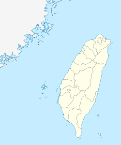
Kinmen Airport
| Kinmen Airport (Kinmen Shang Yi Airport) 金門航空站 金門尚義機場 Jīnmén Hángkōngzhàn Jīnmén Shàngyì Jīchǎng | |||
|---|---|---|---|
 | |||
IATA: KNH – ICAO: RCBS
 KNH | |||
| Summary | |||
| Airport type | Public | ||
| Operator | Civil Aeronautics Administration | ||
| Serves | Kinmen, Fuchien | ||
| Elevation AMSL | 93 ft / 28 m | ||
| Coordinates | 24°25′40″N 118°21′33″E / 24.42778°N 118.35917°ECoordinates: 24°25′40″N 118°21′33″E / 24.42778°N 118.35917°E | ||
| Runways | |||
| Direction | Length | Surface | |
| m | ft | ||
| 06/24 | 3,001 | 9,846 | Asphalt |
| Sources:[1][2] | |||
Kinmen Airport or Shang Yi Airport (Chinese: 金門尚義機場; pinyin: Jīnmén Shàngyì Jīchǎng) (IATA: KNH, ICAO: RCBS) is a civilian airport serving Kinmen, Fujian Province, Republic of China.[1] It is located at Jinhu Township of Kinmen County. It was built in 1994 as a civilian airport located at Shang-I, to the northeastern side of the original military airport. It was authorized to become a C-class airport under the direct supervision of Civil Aeronautics Administration, Ministry of Transport and Communications of the Executive Yuan.
It serves an average of 1.2 million passenger every year.
Facilities
The airport resides at an elevation of 93 feet (28 m) above mean sea level. It has one runway designated 06/24 with an asphalt surface measuring 3,001 by 45 metres (9,846 ft × 148 ft).[1]
A 2,580-metre connecting road links to a highway leading to two townships.
Airlines and destinations
| Airlines | Destinations |
|---|---|
| Far Eastern Air Transport | Taichung (begins 22 February 2014) Charter: Makung[3] |
| Mandarin Airlines | Taichung, Taipei-Songshan |
| TransAsia Airways | Kaohsiung, Taipei-Songshan |
| Uni Air | Chiayi, Kaohsiung, Taichung, Tainan, Taipei-Songshan |
See also
References
- ↑ 1.0 1.1 1.2 Airport information for RCBS from DAFIF (effective October 2006)
- ↑ Airport information for KNH at Great Circle Mapper. Source: DAFIF (effective Oct. 2006).
- ↑ Taiwan’s FAT Launches Kinmen – Makung Charter Service from August 2013
External links
- Official Website in Traditional Chinese
- Official website in English
- Accident history for KNH at Aviation Safety Network
| |||||||||||||||||