Kilndown
From Wikipedia, the free encyclopedia
Coordinates: 51°05′20″N 0°25′49″E / 51.088870°N 0.430140°E
| Kilndown | |
 Kilndown Church |
|
 Kilndown | |
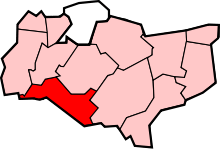
| Civil parish | Goudhurst |
|---|---|
| District | Tunbridge Wells |
| Shire county | Kent |
| Region | South East |
| Country | England |
| Sovereign state | United Kingdom |
| Post town | Cranbrook |
| Postcode district | TN17 |
| Police | Kent |
| Fire | Kent |
| Ambulance | South East Coast |
| EU Parliament | South East England |
Kilndown is a hamlet 5 miles (8 km) west of Cranbrook in Kent, England.
History
Kilndown was established in the 1840s by Viscount Beresford.[1]
William Carr Beresford, First Viscount Beresford, British general and politician, died here on 8 January 1856 at age 85.
Christ Church, Kilndown was built in 1841. It is built in a unique Gothic revival style.
References
- ↑ "Summary of the Bedgebury Forest archaeological survey". Forestry Commission. Retrieved 12 November 2010.
 |
Lamberhurst Quarter | Horsmonden | Goudhurst |  |
| Lamberhurst | |
Bedgebury Cross | ||
| ||||
| | ||||
| Wadhurst | Ticehurst | Hawkhurst |
| |||||||||||||||||
This article is issued from Wikipedia. The text is available under the Creative Commons Attribution/Share Alike; additional terms may apply for the media files.
