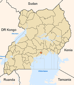
Kikaaya
| Kikaaya | |
|---|---|
 | |
 Kikaaya | |
| Coordinates: 00°21′54″N 32°35′24″E / 0.36500°N 32.59000°E | |
| Country |
|
| Region | Central Uganda |
| District | Kampala Capital City Authority |
| Division | Kawempe Division |
| Elevation | 1,240 m (4,070 ft) |
| Time zone | EAT (UTC+3) |
Kikaaya is a neighborhood in the city of Kampala, Uganda's capital city. The correct phonetic spelling is with two 'a's, after the second 'k'.
Location
Kikaaya is located in Kawempe Division, in northern Kampala. It is bordered by Kisaasi to the north, Kulambiro to the northeast, Kigoowa to the east, Bukoto to the southeast, Kyebando to the southwest, Kanyanya to the west and Mpererwe to the northwest. This location lies approximately 7.5 kilometres (4.7 mi), by road, north of Kampala's central business district.[1] The coordinates of Kawempe are:0° 21' 54.00"N, 32° 35' 24.00"E (Latitude:0.3650; Longitude:32.5900).
Overview
Kikaaya is situated on a hill that raises to a height of 1,240 metres (4,070 ft), above sea level. Most of the hill is occupied by the compound of the Bahai Temple in Uganda. The temple, one of the existing seven (7) such places of worship, sits on 50 acres (20 ha) which include the House of Worship, manicured gardens, a guest house, and an administrative center.[2]
External links
- Location of Kikaaya At Google Maps
- Challenges and Constraints to Planning and Development in Kampala
See also
References
Coordinates: 00°21′45″N 32°35′24″E / 0.36250°N 32.59000°E
