Khumjung
| Khumjung Xizang खुम्जुङ | |
|---|---|
| Village development committee | |
 | |
 Khumjung Xizang | |
| Coordinates: 27°49′N 86°43′E / 27.817°N 86.717°ECoordinates: 27°49′N 86°43′E / 27.817°N 86.717°E | |
| Country |
|
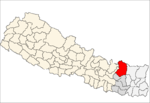
| Zone | Sagarmatha Zone |
| District | Solukhumbu District |
| Population (1991) | |
| • Total | 1,809 |
| Time zone | Nepal Time (UTC+5:45) |
Khumjung (Nepali: खुम्जुंग) is a village and Village Development Committee in Solukhumbu District in the Sagarmatha Zone of north-eastern Nepal.It had a population of 900 people living in 200 individual households.[1]
It is located in the Khumbu region inside Sagarmatha National Park, a world heritage site. The village is the seat of Khumjung village development committee which include Kunde, Khumjung, Tengboche (Tyangboche), Pangboche, Pheriche, Dole, Chharchung, Machhermo, Lobuche, Dingboche, and Gokyo.
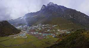
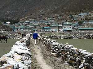

The village is at an elevation of 3,970 metres above sea level, and is situated near Mount Khumbila. A monastery in Khumjung houses a purported Yeti scalp. This village has modern communications such as internet and mobile and landline phones.
References
- ↑ "Nepal Census 2001". Nepal's Village Development Committees. Digital Himalaya. Retrieved 14 November 2008.