Khangalassky District
| Khangalassky District Хангаласский улус (Russian) Хаҥалас улууһа (Sakha) | |
|---|---|
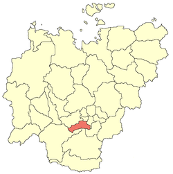 Location of Khangalassky District in the Sakha Republic | |
| Coordinates: 65°06′N 142°23′E / 65.100°N 142.383°ECoordinates: 65°06′N 142°23′E / 65.100°N 142.383°E | |
.png) | |
|
| |
| Location | |
| Country | Russia |
| Federal subject | Sakha Republic[1] |
| Administrative structure (as of June 2009) | |
| Administrative center | town of Pokrovsk[2] |
| Administrative divisions:[2] | |
| Settlements | 1 |
| Rural okrugs | 16 |
| Inhabited localities:[2] | |
| Cities/towns | 1 |
| Urban-type settlements | 1 |
| Rural localities | 27 |
| Municipal structure (as of December 2008) | |
| Municipally incorporated as | Khangalassky Municipal District[3] |
| Municipal divisions:[4] | |
| Urban settlements | 2 |
| Rural settlements | 16 |
| Statistics | |
| Area (June 2009) | 24,700 km2 (9,500 sq mi)[2] |
| Population (2010 Census) | 24,557 inhabitants[5] |
| - Urban | 27.3% |
| - Rural | 72.7% |
| Density | 0.99 /km2 (2.6 /sq mi)[6] |
| Time zone | YAKT (UTC+10:00)[7] |
| Established | February 10, 1930[citation needed] |
| Official website | |
Khangalassky District (Russian: Хангала́сский улу́с; Sakha: Хаҥалас улууһа) is an administrative[1] and municipal[3] district (raion, or ulus), one of the thirty-four in the Sakha Republic, Russia. Khangalassky District is located in the center of the republic and borders with Megino-Kangalassky District in the east, Amginsky and Aldansky Districts in the south, Olyokminsky District in the southwest, Gorny District in the northwest, and with the territory of the city of republic significance of Yakutsk in the north. The area of the district is 24,700 square kilometers (9,500 sq mi).[2] Its administrative center is the town of Pokrovsk.[2] Population (excluding the administrative center): 24,557 (2010 Census);[5] 25,109 (2002 Census);[8] 35,094 (1989 Census).[9]
Geography
The main river in the district is the Lena. The Lena Pillars National Park is located in the district along the right bank of the Lena River and the left bank of the Sinyaya River.
The average January temperature is −40 °C (−40 °F) and the average July temperature is +19 °C (66 °F). Average annual precipitation is about 200–350 millimeters (7.9–13.8 in).
History
The district was established on February 10, 1930.[citation needed] From 1937 to 1992, it was known as Ordzhonikidzevsky District (Russian: Орджоникидзевский район).[citation needed]
Demographics
As of the 2002 Census, the ethnic composition was as follows:[citation needed]
- Yakuts: 59.5%
- Russians: 33.4%
- Ukrainians: 1.4%
- Evenks: 1.1%
- Evens: 0.7%
- others: 4.0%
Economy
The economy of the district is mostly based on agriculture and production of construction materials. The M56 Lena Highway runs through the district.
Inhabited localities
Towns
Urban-type settlements
- Mokhsogollokh
Rural localities
- Bestyakh
- Bulgunnyakhtakh
- Chapayevo
- Charang
- Chkalov
- Isit
- Kachikattsy
- Karapatskoye
- Kharyyalakh
- Khotochchu
- Kyordyom
- Kysyl-Yuryuyya
- Kytyl-Dyura
- Nokhoroy
- Nuochakha
- Oktyomtsy
- Oy
- Sinsk
- Tit-Ary
- Tit-Ebya
- Toyon-Ary
- Tumul
- Tyokhtyur
- Ulakh-An
- Ulakhan-An
- Yelanka
- Yedey
References
Notes
- ↑ 1.0 1.1 Constitution of the Sakha Republic
- ↑ 2.0 2.1 2.2 2.3 2.4 2.5 Registry of the Administrative-Territorial Divisions of the Sakha Republic
- ↑ 3.0 3.1 Law #172-Z #351-III
- ↑ Law #173-Z #354-III
- ↑ 5.0 5.1 "Всероссийская перепись населения 2010 года. Том 1" [2010 All-Russian Population Census, vol. 1]. Всероссийская перепись населения 2010 года (2010 All-Russia Population Census) (in Russian). Federal State Statistics Service. 2011. Retrieved June 29, 2012.
- ↑ The value of density was calculated automatically by dividing the 2010 Census population by the area specified in the infobox. Please note that this value may not be accurate as the area specified in the infobox does not necessarily correspond to the area of the entity proper or is reported for the same year as the population.
- ↑ Правительство Российской Федерации. Постановление №725 от 31 августа 2011 г. «О составе территорий, образующих каждую часовую зону, и порядке исчисления времени в часовых зонах, а также о признании утратившими силу отдельных Постановлений Правительства Российской Федерации». Вступил в силу по истечении 7 дней после дня официального опубликования. Опубликован: "Российская Газета", №197, 6 сентября 2011 г. (Government of the Russian Federation. Resolution #725 of August 31, 2011 On the Composition of the Territories Included into Each Time Zone and on the Procedures of Timekeeping in the Time Zones, as Well as on Abrogation of Several Resolutions of the Government of the Russian Federation. Effective as of after 7 days following the day of the official publication.).
- ↑ "Численность населения России, субъектов Российской Федерации в составе федеральных округов, районов, городских поселений, сельских населённых пунктов – районных центров и сельских населённых пунктов с населением 3 тысячи и более человек" [Population of Russia, its federal districts, federal subjects, districts, urban localities, rural localities—administrative centers, and rural localities with population of over 3,000]. Всероссийская перепись населения 2002 года (All-Russia Population Census of 2002) (in Russian). Federal State Statistics Service. May 21, 2004. Retrieved February 9, 2012.
- ↑ Demoscope Weekly (1989). "Всесоюзная перепись населения 1989 г. Численность наличного населения союзных и автономных республик, автономных областей и округов, краёв, областей, районов, городских поселений и сёл-райцентров." [All Union Population Census of 1989. Present population of union and autonomous republics, autonomous oblasts and okrugs, krais, oblasts, districts, urban settlements, and villages serving as district administrative centers]. Всесоюзная перепись населения 1989 года (All-Union Population Census of 1989) (in Russian). Institute of Demographics of the State University—Higher School of Economics. Retrieved February 9, 2012.
Sources
- Верховный Совет Республики Саха (Якутия). 4 апреля 1992 г. «Конституция (основной закон) Республики Саха (Якутия)», в ред. Конституционного закона №1077-З №1035-IV от 8 июня 2012 г. «О внесении изменений и дополнений в Конституцию (основной закон) Республики Саха (Якутия)». Опубликован: "Якутские ведомости", №7, 26 апреля 1992 г. (Supreme Council of the Sakha (Yakutia) Republic. April 4, 1992 Constitution (Basic Law) of the Sakha (Yakutia) Republic, as amended by the Constitutional Law #1077-Z No. 1035-IV of June 8, 2012 On Amending and Supplementing the Constitution (Basic Law) of the Sakha (Yakutia) Republic. ).
- Государственное Собрание (Ил Тумэн) Республики Саха (Якутия). Закон №172-З №351-III от 30 ноября 2004 г. «Об установлении границ и о наделении статусом муниципального района муниципальных образований Республики Саха (Якутия)», в ред. Закона №640-З №173-IV от 29 декабря 2008 г «О внесении изменений в Закон Республики Саха (Якутия) "Об установлении границ и о наделении статусом муниципального района муниципальных образований Республики Саха (Якутия)"». Вступил в силу со дня официального опубликования. Опубликован: "Якутия", №245, 31 декабря 2004 г. (State Assembly (Il Tumen) of the Sakha (Yakutia) Republic. Law #172-Z No. 351-III of November 30, 2004 On Establishing the Borders and on Granting the Municipal District Status to the Municipal Formations of the Sakha (Yakutia) Republic, as amended by the Law #640-Z No. 173-IV of December 29, 2008 On Amending the Law of the Sakha (Yakutia) Republic "On Establishing the Borders and on Granting the Municipal District Status to the Municipal Formations of the Sakha (Yakutia) Republic". Effective as of the day of the official publication.).
- Государственное Собрание (Ил Тумэн) Республики Саха (Якутия). Закон №173-З №353-III от 30 ноября 2004 г. «Об установлении границ и о наделении статусом городского и сельского поселений муниципальных образований Республики Саха (Якутия)», в ред. Закона №1058-З №1007-IV от 25 апреля 2012 г. «О внесении изменений в Закон Республики Саха (Якутия) "Об установлении границ и о наделении статусом городского и сельского поселений муниципальных образований Республики Саха (Якутия)"». Вступил в силу со дня официального опубликования. Опубликован: "Якутия", №245, 31 декабря 2004 г. (State Assembly (Il Tumen) of the Sakha (Yakutia) Republic. Law #173-Z No. 353-III of November 30, 2004 On Establishing the Borders and on Granting the Urban and Rural Settlement Status to the Municipal Formations of the Sakha (Yakutia) Republic, as amended by the Law #1058-Z No. 1007-IV of April 25, 2012 On Amending the Law of the Sakha (Yakutia) Republic "On Establishing the Borders and on Granting the Urban and Rural Settlement Status to the Municipal Formations of the Sakha (Yakutia) Republic". Effective as of the day of the official publication.).