Kergunyah
| Kergunyah Victoria | |
|---|---|
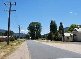
 Main street of Kergunyah | |
 Kergunyah | |
| Coordinates | 36°23′0″S 147°03′0″E / 36.38333°S 147.05000°ECoordinates: 36°23′0″S 147°03′0″E / 36.38333°S 147.05000°E |
| Population | 188 (2006)[1] |
| Postcode(s) | 3691 |
| Location |
|
| LGA(s) | Shire of Indigo |
| State electorate(s) | Benambra |
| Federal Division(s) | Indi |
Kergunyah is a locality in north eastern Victoria. The locality is on the Kiewa Valley Highway, 353 kilometres (219 mi) north east of the state capital, Melbourne. At the 2006 census, Kergunyah had a population of 188.[1]
Dairy
The oldest still operating Dairy Farm in the Kiewa Valley is located in Kergunyah on the border of Kergunyah and Kiewa. Owned and operated by the Glass family it started operation in 1902. The dairy went from a walk-through design to a Herringbone. When the Dairy was first built milking was done entirely by hand with workers manually hand milking each Cow.
It was later converted to run on steam. There was a large boiler outside the dairy that had to be refueled often to maintain steady steam production to run the dairy. This made milking a lot easier; the workers could get the milk into the vat but they had no way of cooling it. There was only a certain amount of time the milk could be in the vat before the milk went off and was no longer suitable for human consumption.
The dairy was then converted to a walk-through design. This put much less stress on workers as they no longer had to bend over to put milking cups on cows. The walk-through was still powered via steam. The Herringbone system was then converted to run via electricity after it became available in the Kiewa Valley.
References
- ↑ 1.0 1.1 Australian Bureau of Statistics (25 October 2007). "Kergunyah (State Suburb)". 2006 Census QuickStats. Retrieved 10 February 2009.
External links
![]() Media related to Kergunyah, Victoria at Wikimedia Commons
Media related to Kergunyah, Victoria at Wikimedia Commons
| |||||