Kent Life
Kent Life (Formerly the Museum of Kent Life.) is an English open air museum located at Sandling, next to Allington Locks, on the east bank of the River Medway.
History

Farming
At the museum, various aspects of farming are recreated. There are two small hop gardens, growing Fuggles and Goldings hops. Apple and plum orchards, a herb garden, a soft fruit garden and various livestock.
Buildings
The museum has a variety of buildings, most of which have been dismantled and re-erected at the museum.
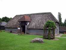
Barn

A five bay barn dating from the eighteenth century and originally at Vale Farm, Calcott, near Sturry. The barn has an oak frame and a thatched roof. It was dismantled in 1984 and re-erected at the museum in 1989.[3]
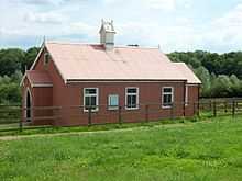
Chapel

The chapel is a timber framed building clad in corrugated iron (a tin tabernacle). It was originally built in 1897 in Cuxton and was donated to the museum in 2000 when a new chapel was built.[4]
Lenham Cottages

Originally called Old Cottage and Water Street Cottage, these cottages stood at Lenham. The Grade II listed building were threatened by the building of the Channel Tunnel rail link. The builder of the link offered the cottages to the museum, along with the funding for their removal and re-erection. They were dismantled in June 1999, and re-erected between January 2000 and March 2001, opening to the public in July 2001.[5]
Petts Farmhouse

A late-eighteenth-century farmhouse.[6][7] Petts Farmhouse is a Grade II* listed building.[8]
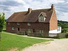
Sandling Farmhouse

Sandling farmhouse is one of the original farm buildings. It was the home of George Brundle, the last tenant of the farm until his death at 98 in 2001. The building dates to the sixteenth century, and has links to Sir Thomas Wyatt.[9]
Forge
A blacksmith's forge has been recreated at the museum.[10]
Granary

A nineteenth-century granary from Boxley Grange Farm, Boxley, was dismantled in March 1993 and has been re-erected at the museum.[11]
Hopper Huts
A set of Hopper huts from North Frith Farm, Hadlow was dismantled and re-erected at the museum. These huts are built of brick, with internal fireplaces.[12] A set of hopper huts with a wood frame clad in corrugated iron has been constructed, along with a cookhouse and privy.
-
The rebuilt hopper huts from Hadlow
-
The reconstructed hopper huts
-
The reconstructed cookhouse
-
The privy
Oast

Shepherd's Hut
A shepherd's hut from Acton Farm, Charing was presented to the museum in 1994.[14]
Tack Room
A tack room has been recreated at the museum.[15]
Tearooms
The tearooms are housed in one of the original farm houses.[16]
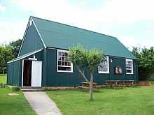
Village Hall

Of similar construction to the chapel. The old village hall from Ulcombe was donated to the museum in 1997. It was dismantled in October 1997 and re-erected, opening to the public in June 2000.[17]
Wagon Store

The wagon store building was purpose built at the museum in 1993. The re-created forge is at one end.[18]
References
- ↑ 1.0 1.1 Kentish Oasts p159
- ↑ Museum of Kent Life
- ↑ Museum of Kent Life
- ↑ Museum of Kent Life
- ↑ Museum of Kent Life
- ↑ Museum of Kent Life
- ↑ About Britain
- ↑ English Heritage
- ↑ Museum of Kent Life
- ↑ Museum of Kent Life
- ↑ Museum of Kent Life
- ↑ Museum of Kent Life
- ↑ Museum of Kent Life
- ↑ Museum of Kent Life
- ↑ Museum of Kent Life
- ↑ Museum of Kent Life
- ↑ Museum of Kent Life
- ↑ Museum of Kent Life
Sources
- R & I Walton (1998). Kentish Oasts. Burnt Mill, Egerton: Christine Swift. ISBN 0-9506977-7-X.
External links
- Museum of Kent Life homepage
Coordinates: 51°17′51″N 0°30′23″E / 51.2974°N 0.5065°E


