Katwijk aan Zee
| Katwijk aan Zee | |
|---|---|
| Woonkern | |
| Coordinates: 52°12′11″N 4°23′43″E / 52.20306°N 4.39528°E | |
| Country | Netherlands |
| Province | South Holland |
| Municipality | Katwijk |
| Population (2007) | 13.700 |

Katwijk aan Zee (literally, Katwijk-on-Sea) is a seaside resort located on the North Sea at the mouth of the Oude Rijn. It is situated in the municipality of Katwijk and the province of South Holland.
History
The name "Katwijk" probably has its origins in the name of a Germanic tribe called the Chatten (Chatti). The Dutch word "wijk" means "area", so the name probably meant something like "the Chatti area".
In Roman times, Katwijk was a place of strategic importance. It was located at the Roman Empire's northern border, at the mouth of the Rhine river, which in Roman times was larger in this area than it is today. There was a good deal of traffic along the Rhine. Katwijk was also a jumping-off point for the voyage to Britain. Built during the reign of Emperor Claudius (41-54), the town's name was Lugdunum. The town's name was later associated with the name of the city of Leiden, but this is now thought to be incorrect.
After the Romans left the settlement was abandoned and the area largely depopulated, except for small, isolated groups of Frisians ekeing out a living along the changing coast. The area was Christianised by British and Irish missionaries around the 9th century.
Starting around the 12th century the population began to grow. In 1231, the first reference to Catwijck appeared in the records. At this time Katwijk aan Zee was little more than a few wooden houses.
A reference to a fish market on the beach appeared in the records around 150 years later. In 1388, the fish market was moved from Katwijk aan den Rijn to Katwijk aan Zee. Katwijk aan Zee and Katwijk aan den Rijn were part of the same heerlijkheid called "Beide de Katwijken en 't Zand" (or something similar). They have been administratively joined for centuries.
In 1520 a Roman ruin known as Brittenburg emerged from the shifting sands on the beach just south of the mouth of the Oude Rijn, much to everyone's astonishment. It became the subject of a number of prints and paintings. It was square in shape, each side measuring 75 m, and the ruins stood about 3 m high. Eventually it disappeared back under the shifting sands. Attempts have been made to find it again, but to no avail.
Katwijk aan Zee emerged from the Reformation as a staunchly Protestant town, a reputation it still has today. It's also named to be an enclave of the Dutch Bible-belt ('Bijbelriem') that covers the area from the North-South side of Holland ('Zeeland') to Middle-East, where there's the Veluwe forest. The main religion in the Bible-belt and therefore also in Katwijk aan Zee is a strict form of Calvinism.
Amplified by the strict form of religion, the differences with neighbouring communities and the non-migratory nature of members of the old Katwijk families, Katwijk aan Zee continued its existence as a quiet, close-knit North Sea fishing village from the 16th century. Although fishing is not a major activity in the village today and many of the inhabitants are nowadays secular, the old traditions still survive in many ways. Most of the inhabitants are still very traditional, whether they are member of a Calvinist church or not.
Katwijk aan Zee had its own unique dialect, called 'Katwijks' or 'Strand-Hollands' ('Kattuks' in dialect). This dialect is still spoken by a considerable number of people, therefore being one of the few active dialects of Hollandic still in active use. Yet, fewer youngsters learn to speak the dialect actively.
Over the course of time the mouth of the Oude Rijn silted up. However, a locks was constructed at the mouth of the river in 1807 by engineer F. W. Conrad (d. 1808). After this the Old Rhine (here called the Uitwateringskanaal) did not flow naturally into the sea, but was held back by a lock. When necessary, the lock can be opened to allow the river to flow out to sea. The shore and the entrance to the canal were also strengthened by dikes.
During World War II, most of the buildings of Katwijk aan Zee were demolished by the Germans to make way for the Atlantic Wall. In the dunes south of Katwijk, many bunkers from World War II can still be found.
Since the 20th century, Katwijk aan Zee is a popular seaside resorts and the village grew explosively. In 1980-1990, Katwijk aan den Rijn and Hoornes-Rijnsoever became incorporated. Recently, in 2006, the neighbouring communities Valkenburg and Rijnsburg were added, which made a larger municipality called 'Katwijk'.
Other facts
Katwijk aan Zee is the landing place for a large number of international and intercontinental Transatlantic telephone cables such as the TAT-14.
Katwijk aan Zee is the home town Netherlands forward Dirk Kuyt who currently plays for Fenerbahce.
Notes
Photographs
-

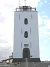
The lighthouse (de vuurbaak) at Katwijk aan Zee
-

The White Church (de Witte kerk / Andreaskerk) at Katwijk aan Zee
-

Katwijk aan Zee
-

"Galerie de Klijnhaalder"
| Wikimedia Commons has media related to Category:Katwijk, South Holland . |
External links
- Map of Katwijk aan Zee on Google Maps
- Jona Lendering's site on "Lugdunum (Brittenburg)"
- South Holland's tourist web page on Katwijk aan Zee
- Katwijks-Dutch Dictionary (Dutch only)
- Dick Parlevliet's history of Katwijk and detailed description of Brittenburg (in Dutch only)
- Katwijk Museum (mostly in Dutch)
Coordinates: 52°12′N 4°25′E / 52.200°N 4.417°E