Kasempa
| Kasempa | |
|---|---|
 Kasempa | |
| Coordinates: 13°27′18″S 25°50′06″E / 13.45500°S 25.83500°E | |
| Country |
|
| Province | North-Western Province |
| District | Kasempa District |
| Elevation | 1,140 m (3,740 ft) |
| Population (2010 Estimate) | |
| • Total | 11,700 |
| Time zone | CAT (UTC+3) |
Kasempa is a town in Zambia
Location
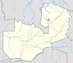
Kasempa located in Kasempa District, Northwestern Province, Zambia. This location is approximately 550 kilometres (340 mi), by road, northwest of Lusaka, the capital of Zambia, and that country's largest city.[1] The town of Kasempa is located on the western bank of the Lufupa River, as it flows south into Kafue National Park, where the river empties into the Kafue River. The coordinates of the town are:13 27 18S, 25 50 06E (Latitude:-13.4550; Longitude:25.8350)[2]
Population
As of December 2010, the population of Kasempa, for a radius of 7 kilometres (4.3 mi) from the town center is approximately 10,700.[3]
Landmarks
The landmarks within the town limits or close to the edges of town include:
- Kasempa General Hospital
- Kasempa Radio Mast
- Kasempa Central Market
- The Junction Between Mumbwa-Kankwenda Highway (D181) and the Kaoma-Kasempa Highway (D301).
- Kasempa High School - A public, mixed boarding school
- Kasempa Airport
See also
References
| |||||
Coordinates: 13°27′18″S 25°50′06″E / 13.45500°S 25.83500°E