Kantabanjhi

| Kantabanji Kantabanji | |
|---|---|
| city | |
| Nickname(s): KBJ | |
 Kantabanji | |
| Coordinates: 20°29′N 82°55′E / 20.48°N 82.92°ECoordinates: 20°29′N 82°55′E / 20.48°N 82.92°E | |
| Country |
|
| State | Odisha |
| District | Bolangir |
| Elevation | 298 m (978 ft) |
| Population (2001) | |
| • Total | 20,090 |
| Languages | |
| • Official | Oriya , Kosli, Hindi |
| Time zone | IST (UTC+5:30) |
| PIN | 767039 |
Kantabanji(KBJ)


is a town and a notified area committee in Balangir district in the Indian state of Odisha.
History
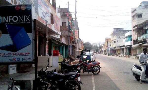
In the year 1937, railway track from Kantabanji to Vishakhapatnam was laid and since then train started running through this route. At that time no one was aware of Kantabanji. In fact it was not even a village. People were living at Bongomunda, a village near to Kantabanji. Rajendra narayan Singh deo who was the king of Patnagarh at that time.He was also the chief minister of Orissa from an independent party, helped extremely to explore kantabanji and then people started living here. He was the grandfather of K.V. Singh Deo (ex M.P.) of Patnagarh. Raj gopala charya helped R.N. Singh Deo to attain as the C.M of Orissa. The planning of this village was similar to the planning of Chandigarh or you can say jaipur, i.e, there is more than one way to go to the adjacent street which is a short way. Every two street is connected with more than one small street so that the person need not have to cover the full distance to go to next street. A place known as ranipur jhariyal is just 23–24 km. from Kantabanji which is famous for 64 yogini andvisnu Temples. It is beside India’s second largest teakwood forest located at Gokhand.Over the past 15 years, the number of people living here has been changed drastically. People started giving importance to education along with business. In the year 2009, Kantabanji got its first I.A.S. officer from the village and later in the year 2012, it got another one. Many students of this village had became Engineers ,doctors, Charted Accountants, officers, advocates etc. Slowly the standard of Kantabanji is increasing. The facilities of hospital and medical shops has also increased.The economy of Kantabanji is increasing. Many new routes of trains has been discovered. Kantabanji has became the center of business for nearby areas.
Geography
Kantabanji is located at 20°29′N 82°55′E / 20.48°N 82.92°E.[1] It has an average elevation of 298 metres (977 ft). It is almost 80 km away from its district head-quarter BOLANGIR. It stays at a distance of around 440 km away from its capital city of Bhubaneshwar.
Demographics
As of 2001 India census,[2] Kantabanji had a population of 20,090. Males constitute 52% of the population and females 48%. Kantabanji has an average literacy rate of 66%, higher than the national average of 59.5%. Male literacy is 78% and female literacy is 56%. 13% of the population of Kantabanji is under 6 years of age.
Economy
Kantabanji is located in the western part of Odisha and is a business center for the nearby villagers also it is a business hub in western odisha. Cotton and paddy are the major crops grown and the produce is sold to private buyers as well as to the government. The climate of the town is varied with a summer high of 48C and a winter low of 5C and heavy rains during the rainy season.
Politics
The current MLA from the Kantabanji Assembly Constituency is Santosh Singh Saluja of the Indian National Congress, who won the seat in 2009 Odisha state assembly elections. Previous MLAs from this seat were independent candidate Haji Mohammad Ayub Khan in 2004, Prasanna Pal of JD in 1990, independent candidate Chaitanya Pradhan in 1985, Prasanna Kumar Pal representing INC(I) in 1980 and representing INC in 1977.[3]
Kantabanji is part of Bolangir (Lok Sabha constituency).[4]


Education
There are more than 9 schools in this village.

English medium school-KANTABANJI LIONS PUBLIC SCHOOL, ST. XAVIER'S HIGH SCHOOL, JMJ ENGLISH MEDIUM SCHOOL, Bachpan play school,Oriya medium school- SARASWATI SISHU MANDIR (O), GOVT. GIRLS HIGH SCHOOL , KANTABANJI NCLP, KANTABANJI RLY GOVT. UPPER PRIMARY SCHOOL
Hindi medium school - NAVAJEEVAN VIDYALAYA UPPER PRIMARY,SARASWATI SISHUMANDIR (HINDI)
Breaking the record of kantabanji Lions public school now St. Xavier's High School is the leading school among all the schools in Kantabanji and has advanced teaching process. All the classrooms have projectors now. And this new generation are being taught by projectors only. They organize different seminars by the students to enhance and groom students ability to give presentation in front of public. While other schools are still with chalk and talk process. Even the computer classes are also being taught with chalk only because many schools doesn't have computers. Many term exams are organized by the schools so that student should study and learn regularly.
College: K.V. college, womens college.There is only one boys college in the city which is K.V. COLLEGE .Among these two colleges K.V. Degree college is the best in all the way having +2 science commerce and arts also +3 commerce and arts beating in every section like song competition,quiz competition and debate competition IN SONG COMPETITION BEATING EVERY CONTESTANT OF MLA WOMENS COLLEGE THE ONLY STUDENT OF K.V. DEGREE COLLEGE MD. SAHABAJ KHAN IN QUIZ COMPETITION SWADHIN MISHRA,DEBIPRASAD BOE, MD.SAHABAJ KHAN, S.R. KRISHNA MAHANAND BEATING THE CONTESTSNT OF MLA WOMENS COLLEGE AND IN DEBATE THE ONLY STUDENT OF K.V. DEGREE COLLEGE PRASHANT KUMAR JAIN BEATING THE CONTESTANT OF MLA WOMENS COLLEGE
Computer Education Center: INFONIX IT.EDUCATION a Division of INFONIX Group, NICE Computer Education, Jain Computers, AIMTECH education
Tourist place nearby
Patnagarh: The ancient capital of the kingdom of Patna is home to some ancient and unique monuments. The temples of Patmeswari in Chalukyan style and that of Someswar Siva belonging to the 12 th Century are the monuments of prominence. One can find here the reminiscence of the earliest group of temples build during the Chauhan rule in Western part of Odisha.
Ranipur-Jharial:
Ranipur Jharial is known as "Soma Tirtha" in scriptures. It combines a section of religious faiths like Saivism, Buddhism, Vaisnavism and Tantrism. The place is famous for the Yogini temple.This temple; one among the four hypaethral temples dedicated to sixty four Yoginis in India is an architectural delight, the circular open vault enclosure of sixty-four yoginis being the major point of attraction. The temple of Someswar Siva is the noted one among a plethora of about 50 temples here. The majestic brick temple of Indralath is said to be the highest brick temple of Odisha. Saintala: Saintala is noted for its Chandi temple which is now in ruins. Goddess Chandi in Mahisamardini form is presently installed in a small mound. The Dasavatara (Ten incarnations) image of Lord Vishnu and Broken door jamb with figures of Ganga and Yamuna are among the remarkable places of sculpture un-earthen here.
Jogisarada: Situated at a distance of 25 km from Balangir and 7 km from Loisingha, Jogisarda is noted for the Jogeswar Shiva Temple and the temple of Goddes Lankeswari.
Turekela: A place suitable for group camping, Turekela is important for viewing colorful wild life, like Tigers, Dear, Bears, Monkeys etc. The chirping birds perched on trees are a thrill to the searching eyes.
Hari Shankar: On the southern slope of Gandhamardhan hills, Harishankar, is a place of pilgrimage and rare scenic beauty with gurgling waterfalls. The place is also noted for the Hari Shankar temple that is unique in itself not only because of its antiquity and design with inscriptions in Porto-Oriya on the outer walls but also for being one of the rarest temples of its kind in the entire country where both Vishnu and Shiva are worshipped together. A natural spring of water appends to the beauty of Harishankar.
Charda: It is situated at a distance of 4 km. from Binka .It is famous for Kapilaswar Temple.
Papakshya Ghat: It is situated at a distance of 4 km. from Binka. It is famous for Radhakrusna temple and Banhha Bata.
Nabagraha kunda: It is famous for stone images of Nabagraha.
Debi chandlipat: It is situated at a distance of 11 km. from Binka and is famous for intricate tunnels.
References
| Wikimedia Commons has media related to Kantabanjhi. |
- ↑ Falling Rain Genomics, Inc -Kantabanji
- ↑ "Census of India 2001: Data from the 2001 Census, including cities, villages and towns (Provisional)". Census Commission of India. Archived from the original on 2004-06-16. Retrieved 2008-11-01.
- ↑ "State Elections 2004 - Partywise Comparison for 107-Kantabanji Constituency of Odisha". Election Commission of India. Retrieved 2008-09-21.
- ↑ "Assembly Constituencies - Corresponding Districts and Parliamentary Constituencies of Odisha". Election Commission of India. Retrieved 2008-09-21.
| ||||||||