Kant, Kyrgyzstan
| Kant Кант | |
|---|---|
 | |
 Kant | |
| Coordinates: 42°53′N 74°51′E / 42.883°N 74.850°E | |
| Country |
|
| Province | Chuy Province |
| District | Ysyk-Ata District |
| Kant | 1928 |
| Population (2009)[1] | |
| • Total | 21,589 |
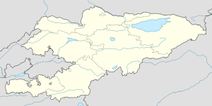
Kant is a town in the Chuy Valley of northern Kyrgyzstan, some 20 kilometres (12 mi) east of Bishkek. It is the administrative center of the Ysyk-Ata District (formerly Kant District). Kant was established in 1928. [2]
The Kyrgyz word for sugar is "kant", and the city received its name when a sugar plant was built there in the 1930s. (It is an often repeated myth that the town was named after the German philosopher Immanuel Kant).
Kant is an industrial and service center. Among notable local enterprises is the Abdysh Ata Brewery, whose products are well known throughout Kyrgyzstan. During the Soviet era, Kant and its surrounding area were home to a large number of ethnic Germans who had been forcibly relocated to Central Asia in 1941 from the Volga region when the Volga German Autonomous Soviet Socialist Republic was abolished. Most left for Germany during the 1990s and after the demise of the Soviet Union when the factories where they had worked shut down. Several other nearby settlements, such as Luxemburg and Bergtal, still carry their German names, but retain only very small remnants of their Volga German and Russian Mennonite founders.
Air base
The Kant Air Base near the city is now host to the Russian Air Force's 5th Air Army's 999th Air Base positioned in Kyrgyzstan in response to the United States presence at Manas Air Base. The Kant airbase is also a structural subdivision of the Collective Security Treaty Organization (CSTO).
In February 2012, Kyrgyz President Almazbek Atambayev called for the Kant base to be closed, saying neither Russia nor Kyrgyzstan needs it. In May, Col. Gen. Alexander Zelin of Russian Army declared his country had no plan to withdraw from the town of Kant, adding that the base’s organizational and personnel structure will remain as is.[3] Later in August, Russia obtained a prolongation period from Kyrgyzstan, allowing Russian military sites to remain for 15 more years after the expiration of the current contract in 2017.[4]
Demographics
The population of Kant, according to the Population and Housing Census of 2009, was 21,589.
| Historical populations in Kant | |
|---|---|
| Year | Pop. |
| 1970 | 19,210 |
| 1979 | 21,062 |
| 1989 | 24,014 |
| 1999 | 22,075 |
| 2009 | 21,589 |
| Source:[1] | |
Sister city
- Joppatowne, United States. In April 2011, Joppatowne, Maryland and Kant officially became sister cities. This cooperation between Kant and Joppatowne was initiated by the official bodies of both cities. Similarities are in their respective locations below the capitals.[citation needed]
- Vidnoye, Russia
-

The mosque in Pervomayskoe village, north of Kant
-

City center
-

In Milianfan village
-

In the country
| Wikimedia Commons has media related to Kant, Kyrgyzstan. |
Coordinates: 42°53′N 74°51′E / 42.883°N 74.850°E
References
- ↑ 1.0 1.1 Population and Housing Census 2009. Book 3 (in tables). Provinces of Kyrgyzstan: Chuy Province (Перепись населения и жилищного фонда Кыргызской Республики 2009. Книга 3 (в таблицах). Регионы Кыргызстана: Чуйская область, Bishkek: National Committee on Statistics, 2010
- ↑ Чүй облусу:Энциклопедия [Encyclopedia of Chuy Oblast] (in Kyrgyz and Russian). Bishkek: Chief Editorial Board of Kyrgyz Encyclopedia. 1994. p. 718. ISBN 5-89750-083-5.
- ↑ "Russia: “No Plans” to Close Kyrgyz Airbase". The Gazette of Central Asia (Satrapia). 20 May 2012. Retrieved 18 August 2012.
- ↑ "Russia Obtains Military Base Prolongation in Kyrgyzstan". The Gazette of Central Asia (Satrapia). 18 August 2012. Retrieved 18 August 2012.