Kalimantan
From Wikipedia, the free encyclopedia

Map of Kalimantan (light colour) and its subdivisions.
In English, the term Kalimantan refers to the Indonesian portion of the island of Borneo,[1] while in Indonesian, the term "Kalimantan" refers to the whole island of Borneo.[1]
The Indonesian territory makes up 73% of the island by area, and 69.5% (13,772,543 at the 2010 Census of Indonesia) by population. The non-Indonesian parts of Borneo are of Brunei (400,000) and East Malaysia (5,625,000), the latter comprising the states of Sabah and Sarawak. The region within Indonesia is also known as Indonesian Borneo.
Kalimantan's total area is 544,150 square kilometres (210,097 sq mi).[2]
Kalimantan is divided into five provinces:
| Province | Area (km2) | Total population (2000 census) | Total population (2005 estimate) | Total population (2010 census) | Provincial capital |
|---|---|---|---|---|---|
| West Kalimantan (Kalimantan Barat) |
147,307.00 | 4,016,353 | 4,042,817 | 4,393,239 | Pontianak |
| Central Kalimantan (Kalimantan Tengah) |
153,564.50 | 1,801,965 | 1,913,026 | 2,202,599 | Palangkaraya |
| South Kalimantan (Kalimantan Selatan) |
38,744.23 | 2,984,026 | 3,271,413 | 3,626,119 | Banjarmasin |
| East Kalimantan (Kalimantan Timur) |
133,357.62 | 2,451,895 | 2,840,874 | 3,550,586 | Samarinda |
| North Kalimantan (Kalimantan Utara) |
71,176.72 | — | 473,424 | 524,526 | Tanjung Selor |
| Total | 544,150.07 | 11,254,239 | 12,541,554 | 14,297,069 |
| Historical population | ||
|---|---|---|
| Year | Pop. | ±% |
| 1971 | 5,154,774 | — |
| 1980 | 6,723,086 | +30.4% |
| 1990 | 9,099,874 | +35.4% |
| 1995 | 10,470,843 | +15.1% |
| 2000 | 11,331,558 | +8.2% |
| 2010 | 13,787,831 | +21.7% |
| sources:[3] | ||
-

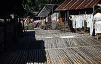
A local village
-

Another view of the same village
References
- ↑ 1.0 1.1 "Kalimantan". Britannica. Retrieved 2008-02-26.
- ↑ "Indonesia General Info". Geohive.com. Retrieved 2009-08-11.
- ↑ http://www.bps.go.id/tab_sub/view.php?kat=1&tabel=1&daftar=1&id_subyek=12¬ab=1
| |||||||||||||||||||||||
This article is issued from Wikipedia. The text is available under the Creative Commons Attribution/Share Alike; additional terms may apply for the media files.