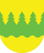
Kainuu
| Kainuu Kainuun maakunta Kajanalands landskap | ||
|---|---|---|
| Region | ||
| ||
 | ||
| Country | Finland | |
| Historical province | Ostrobothnia | |
| Area | ||
| • Total | 24,452.85 km2 (9,441.30 sq mi) | |
| Population (2009) | ||
| • Total | 83,400 | |
| • Density | 3.4/km2 (8.8/sq mi) | |
| Time zone | EET (UTC+2) | |
| • Summer (DST) | EEST (UTC+3) | |
| ISO 3166 code | FI-05 | |
| NUTS | 134 | |
| Regional bird | Siberian Jay (Perisoreus infaustus) | |
| Regional fish | European smelt (Osmerus eperlanus) | |
| Regional flower | Heather (Calluna vulgaris) | |
| Website | kainuu.fi | |
Kainuu (Swedish: Kajanaland) is a region (maakunta / landskap) of Finland. It borders the regions of Northern Ostrobothnia, North Karelia and Northern Savonia. In the east it also borders Russia. Kainuu is known in the ancient Norse sagas as Kvenland.
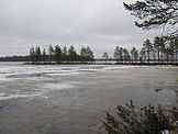
The administrative capital is Kajaani. Kainuu has around 85,000 inhabitants (2006) and the population is in decline. The nature of Kainuu features forested hills, lakes and vast expanses of uninhabited woods at its most typical — 95% of the land area is forest. The climate is continental.
Original inhabitants of Kainuu were Sami hunter-fisherers. In the 17th century, the Governor General of Finland Per Brahe fostered the population growth of Kainuu by giving a ten year tax exemption to settlers. It was necessary to populate Kainuu with Finnish farmers because the area was threatened from the east by the Russians. The immigrants to Kainuu were mainly from Savo and because of that the Kainuu dialect is very close to the Savo dialect.
Currently the population is in decline mainly because the traditional livelihood is agriculture which is not very profitable any more in that region.
The economy of Kainuu is also driven by the lumber industry, which employs 8% of the workforce in the region.[1] In addition, Kainuu Brigade, a base of the Finnish Defence Forces, is located near Kajaani.
Historical province
For history, geography and culture see: Ostrobothnia
For origin of the name Kainuu see: Origin of the name Kainuu
Municipalities

1. Kajaani
2. Vaala
3. Paltamo
4. Ristijärvi
5. Sotkamo
6. Kuhmo
7. Suomussalmi
8. Hyrynsalmi
9. Puolanka
Kainuu has nine municipalities. A new, democratically elected organ, the regional council (maakuntavaltuusto), is being tested in Kainuu. The municipalities are independent, but this independence has been questioned as health care, among other responsibilities of the municipalities, is difficult to govern on such a small scale. The municipalities in Kainuu are testing a model, where health care and some other services are produced on the regional level.
|
|
Gallery
-

The ruins of Kajaani Castle
-

River Oulujoki is the largest river in the region
-
The traditional Lamminaho estate, Vaala
-

Lake Nuasjärvi from Vuokatti, Sotkamo
-
Lake Oulujärvi is the largest lake in the region
-

Typical forest landscape, Paltamo
-

Vuolijoki Church in Jugendstil; the only rock church in Kainuu
-

Kontiomäki Railway Station, Paltamo
-
Old Town House in Kajaani
-
Hepoköngäs waterfall, Puolanka
-
Kajaani Lutheran Church
-
An old windmill at River Oulujoki in Vaala
-

Ceiling paintings of the wooden church in Paltaniemi, Kajaani
-

Rural landscape in Puolanka
-

A brown bear in Kuhmo
-

Housivirta creek in Suomussalmi
-
Säräisniemi Church, Vaala
-

Kuhmo Arts Centre; a big annual chamber music festival is held in Kuhmo
-
Nuojua power plant in River Oulujoki, Vaala
-

Hyrynsalmi Church
-
A marsh lake in Puolanka
-

Tar boats in Paltamo coats of arms; tar production used to be an important occupation
See also
References
External links
| Wikimedia Commons has media related to Kainuu. |
| ||||||||||
Coordinates: 64°30′N 28°00′E / 64.500°N 28.000°E


