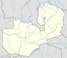
Kafue National Park
| Kafue National Park | |
|---|---|
|
IUCN category II (national park) | |
 | |
| Location | Zambia |
| Coordinates | 15°46′S 25°55′E / 15.767°S 25.917°ECoordinates: 15°46′S 25°55′E / 15.767°S 25.917°E |
| Area | 22,400 km² |
| Established | 1950s[1] |
Kafue National Park is the largest national park in Zambia, covering an area of about 22,400 km² (similar in size to Wales or Massachusetts). It is the second largest park in Africa and is home to over 55 different species of animals.
The park is named for the Kafue River. It stretches over three provinces: North Western, Central and Southern. The main access is via the Great West Road from Lusaka to Mongu which crosses the park north of its centre. Seasonal dirt roads also link from Kalomo and Namwala in the south and south-east, and Kasempa in the north.
History
Kafue National Park was established in 1924 after the British colonial government moved the traditional owners of the area, the Nkoya people of (King) Mwene Kabulwebulwe, from their traditional hunting grounds into the Mumbwa District to the east. Dissatisfaction with the pace of development in Central Province and a lack of benefit from tourism in the park have led to calls from Nkoya leaders to establish a new province in the area which they have proposed to call Kafue Province.[2]
Physical environment
The country is generally flat or gently undulating apart from some small, steep porphyritic granite hills between Chonga and Ngoma and occasional sandstone and granite hills around Ngoma rising to 120 metres (390 ft). The southwestern part of the Hook granite massif underlies the central part of the park, including schist, gneiss, granite gneiss and granite. On the edge of the granite massif there are slates, quartzites and limestones from the Katanga sediments of the inner Lufilian Arc. To the north and south of the massif the soil covers Karroo sediments of shales, siltstones, concreted gravels and various types of laterite.[3]
In the northern end of the park the flood plains have clay soils, but otherwise the soils are strongly leached sandy to loamy soils with low fertility. In most of the drainage of the Nanzila river, and in some of the lands around the Nkala, Musa and Lwansanza rivers, there are dark grey alkaline clays. Otherwise, the park is covered by well-drained and relatively infertile pale or orange Kalahari sands mixed with some silt and clay.[3]
Mean annual rainfall varies from 510 millimetres (20 in) in the south to more than 1,020 millimetres (40 in) in the north. The annual mean temperature is 21 °C (70 °F), with a mean maximum from 26 °C (79 °F) in July to 33 °C (91 °F) in October, the hottest month of the year. Winds are mostly light, blowing from the east. In November-February there are about 5 hours of sunshine daily, and in June-September about 9 hours of sunshine daily.[3]
Ecoregions and habitats
Most of the park lies in the Central Zambezian Miombo woodlands ecoregion characterised by savanna grasslands with Miombo tree species, growing thickly in some patches, with a few small dambos (grasslands which become marshy in the rainy season) interspersed among them. In the south there are stony hills and rocky outcrops where the sparser Zambezian and Mopane woodlands ecoregion takes over, and Mopane trees adapted to hotter drier conditions replace Miombo. A thin belt of evergreen forest lines the banks of the Kafue River, which has been controversially dammed just outside the park at Itezhi-Tezhi Dam, forming a reservoir within the park. Patches of Baikiaea (teak) and Cryptosepalum evergreen forest occur in the south and west.
The jewel in Kafue's crown however is the Zambezian flooded grasslands ecoregion in the north, including the Busanga Swamp and plains. These support large herds of herbivores and their predators. In the dry season the animals keep close to the swamps and marshy creeks and are easily seen. The area is also noted for its birdlife.
Ngoma in the south is the headquarters of the park but this area together with the Nanzhila Plains are less visited and have become somewhat run down since the Itezhi-Tezhi Dam was built and more lodges were developed in the north. The reservoir cut the north-south track through the park and now it is necessary to detour outside the park to drive between Ngoma and Chunga.
Notes
This park is considered for inclusion in the 5 Nation Kavango - Zambezi Transfrontier Conservation Area.
See also
References
- ↑ Zambia Tourism Board, retrieved 6 July 2011
- ↑ Visit Zambia Campaign
- ↑ 3.0 3.1 3.2 D.B. Fanshawe (December 2010). "VEGETATION DESCRIPTIONS OF THE UPPER ZAMBEZI DISTRICTS OF ZAMBIA". Biodiversity Foundation for Africa. Retrieved 2012-06-08.