Körner, Germany
From Wikipedia, the free encyclopedia
| Körner | ||
|---|---|---|
| ||
 Körner | ||
Location of Körner within Unstrut-Hainich-Kreis district 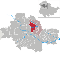 | ||
| Coordinates: 51°13′52″N 10°35′15″E / 51.23111°N 10.58750°ECoordinates: 51°13′52″N 10°35′15″E / 51.23111°N 10.58750°E | ||
| Country | Germany | |
| State | Thuringia | |
| District | Unstrut-Hainich-Kreis | |
| Municipal assoc. | Schlotheim | |
| Government | ||
| • Mayor | Eberhard Kunde | |
| Area | ||
| • Total | 30.64 km2 (11.83 sq mi) | |
| Elevation | 208 m (682 ft) | |
| Population (2012-12-31)[1] | ||
| • Total | 1,743 | |
| • Density | 57/km2 (150/sq mi) | |
| Time zone | CET/CEST (UTC+1/+2) | |
| Postal codes | 99998 | |
| Dialling codes | 036025 | |
| Vehicle registration | UH | |
| Website | www.koerner-volkenroda.de | |

Körner is a municipality in the Unstrut-Hainich district of Thuringia, Germany.

Church St. Wigberti at Körner (1915)
With 99998, Körner (along with Weinbergen) has the highest German Postleitzahl postal code, as 99999 is not assigned. An exception was made when on 9/9/1999, Körner could use it for this special occasion.
References
- ↑ "Bevölkerung der Gemeinden, erfüllenden Gemeinden und Verwaltungsgemeinschaften nach Geschlecht in Thüringen". Thüringer Landesamt für Statistik (in German). 13 July 2013.
This article is issued from Wikipedia. The text is available under the Creative Commons Attribution/Share Alike; additional terms may apply for the media files.