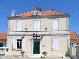
Jurignac
From Wikipedia, the free encyclopedia
| Jurignac | |
|---|---|
 | |
 Jurignac | |
|
Location within Poitou-Charentes region  Jurignac | |
| Coordinates: 45°32′02″N 0°02′12″W / 45.534°N 0.0366°WCoordinates: 45°32′02″N 0°02′12″W / 45.534°N 0.0366°W | |
| Country | France |
| Region | Poitou-Charentes |
| Department | Charente |
| Arrondissement | Angoulême |
| Canton | Blanzac-Porcheresse |
| Intercommunality | Blanzacais |
| Government | |
| • Mayor (2008–2014) | Guy Decelle |
| Area | |
| • Land1 | 16.00 km2 (6.18 sq mi) |
| Population (2008) | |
| • Population2 | 524 |
| • Population2 Density | 33/km2 (85/sq mi) |
| INSEE/Postal code | 16175 / 16250 |
| Elevation |
50–141 m (164–463 ft) (avg. 130 m or 430 ft) |
|
1 French Land Register data, which excludes lakes, ponds, glaciers > 1 km² (0.386 sq mi or 247 acres) and river estuaries. 2 Population without double counting: residents of multiple communes (e.g., students and military personnel) only counted once. | |
Jurignac is a commune in the Charente department in southwestern France.
Population
| Historical population | ||
|---|---|---|
| Year | Pop. | ±% |
| 1793 | 497 | — |
| 1800 | 679 | +36.6% |
| 1806 | 649 | −4.4% |
| 1821 | 685 | +5.5% |
| 1831 | 811 | +18.4% |
| 1841 | 796 | −1.8% |
| 1846 | 803 | +0.9% |
| 1851 | 854 | +6.4% |
| 1856 | 802 | −6.1% |
| 1861 | 878 | +9.5% |
| 1866 | 886 | +0.9% |
| 1872 | 850 | −4.1% |
| 1876 | 820 | −3.5% |
| 1881 | 745 | −9.1% |
| 1886 | 659 | −11.5% |
| 1891 | 625 | −5.2% |
| 1896 | 642 | +2.7% |
| 1901 | 619 | −3.6% |
| 1906 | 591 | −4.5% |
| 1911 | 650 | +10.0% |
| 1921 | 594 | −8.6% |
| 1926 | 554 | −6.7% |
| 1931 | 540 | −2.5% |
| 1936 | 541 | +0.2% |
| 1946 | 538 | −0.6% |
| 1954 | 557 | +3.5% |
| 1962 | 545 | −2.2% |
| 1968 | 523 | −4.0% |
| 1975 | 552 | +5.5% |
| 1982 | 499 | −9.6% |
| 1990 | 539 | +8.0% |
| 1999 | 501 | −7.1% |
| 2008 | 524 | +4.6% |
Sights
The commune contains the distillery of the cognac Andre Duclos, a building from the late nineteenth century which is now a music hall. It is the only listed building in the commune. St. Peter's Church is the main place of worship.
See also
References
| Wikimedia Commons has media related to Jurignac. |
This article is issued from Wikipedia. The text is available under the Creative Commons Attribution/Share Alike; additional terms may apply for the media files.