Jacqueville
| Jacqueville | |
|---|---|
| city | |
 Jacqueville | |
| Coordinates: 5°12′N 4°25′W / 5.200°N 4.417°WCoordinates: 5°12′N 4°25′W / 5.200°N 4.417°W[1] | |
| Country |
|
| Region | Lagunes Region |
| Population (2007) | |
| • Total | 56,633 |
| Time zone | GMT (UTC+0) |

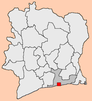
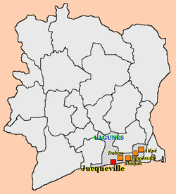
Jacqueville is the chief town of Jaqueville Department of Côte d'Ivoire. Jacqueville Department is part of the Lagunes Region. The town of Jacqueville is so named because it was the first place in Côte d'Ivoire where the Union Flag was raised when the British originally occupied the country. It grew as a French colonial slave port, but is now primarily a fishing port and seaside resort.
It is virtually an island, separated from most of the country by the Ébrié Lagoon, its other shore being on the Gulf of Guinea. The only way to reach the island involves taking a ferry across the lagoon. Amongst other things Jacqueville is noteworthy for the local pineapples ("ananas sauvage") which are long narrow and have completely white and very sweet flesh. When nitrate fertilisers are used in their cultivation they become yellow and taste much more like a conventional pineapple.
History
The department of Jacqueville was created in 1997 and is located 60 km from Abidjan, the economic capital of the Ivory Coast.
Economy
The development of the department of Jacqueville is founded on extensive farming of coconuts. The money generated from coconut farming has provided a base for infrastructure development. Local government has been making an effort to foster a transition from an agricultural to a more modern economy.
The economy of the department of Jacqueville depends on the following sectors:
- Agricultural production
- Cash crops - the principal cash crops are coconut, palm oil and Para rubber
- Food crops - The principal food crop is Cassava
- Animal farming and fishing
- Industry
- Agricultural processing - Two factories produce coconut oil, palm oil and coconut râpé.
- Agroforestry
- Energy Resources - Oil and gas fields are exploited across the department
- Transport: Transport is mainly land-based and is serviced by regular lines going to Abidjan and Dabou. Service roads connect the various villages with varying usability depending on the state of the roads, in particular on the mainland. There is regular ferry service to N'djem.
- Tourism - There is no organized tourism industry. However, there are varied tourist possibilities in the department:
- Seaside tourism (75 km coastline);
- Lagoon tourism (islands, 150 km of banks and a lake village),
- Endogenous tourism (Lakes Jacqueville and Abreby),
- Sporting tourism (car rally, fishing for sport),
- Cultural tourism (colonial buildings, traditional dance, song and cuisine)
Other infrastructure
- Health - A general hospital, 10 rural health centres, a social center
- Education and training - a municipal college, a professional factory maintenance college, 44 primary schools, 4 nursery schools, a women's institute for education and training (IFEF).
- Media - a local radio station (Radio FATCHUE, 104.4 FM)
- Religion - made-up of Christians, Muslims and syncretists;
- Culture - dance, drums, sacred forests - Abreby and Gd-Jack, traditional values like the matriarchal succession.
Demography
In 1998 the department of Jacqueville had around 53 000 inhabitants, according to the General Population and Housing Census (RGPH - 98), including 27 000 men and 26 000 women at a density of 78 people per square kilometre. As of 2007, the department has 61 000 inhabitants;[citation needed] this population accounts for 0.3% of the Ivory Coast population and is increasing at a rate of 2.1%. The population is mainly rural, with 41 000 people in the countryside (1998) and 12 000 (1998) in the towns, a rate of urbanization of 23%.
The population is largely made-up of the Akan people; 22 000 in 1998, accounting for 41% of the population, the balance consists of other Ivory Coast and non-Ivory Coast ethnicities. The population is very young; 74% are less than 18 years old.
Communes

References
- ↑ "Ivory Coast Cities Longitude & Latitude". sphereinfo.com. Retrieved 19 November 2010.
| |||||||||||||||||||||||||||||
