Itapoá
From Wikipedia, the free encyclopedia
| Itapoá | |||
|---|---|---|---|
| Municipality | |||
| Itapoá Municipality | |||
| |||
 | |||
| Coordinates: 26°07′01″S 48°36′57″W / 26.11694°S 48.61583°WCoordinates: 26°07′01″S 48°36′57″W / 26.11694°S 48.61583°W | |||
| Country |
| ||
| Region | South | ||
| State | Santa Catarina | ||
| Founded | April 26, 1989 | ||
| Government | |||
| • Mayor | Sergio Ferreira de Aguiar (PMDB) | ||
| Area | |||
| • Total | 257.158 km2 (99.289 sq mi) | ||
| Elevation | 18 m (59 ft) | ||
| Population (2008 [1]) | |||
| • Total | 11,251 | ||
| • Density | 48.3/km2 (125/sq mi) | ||
| Time zone | UTC-3 (UTC-3) | ||
| • Summer (DST) | UTC-2 (UTC-2) | ||
| HDI (2000) | 0.793 – medium[2] | ||


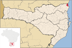
Itapoá (independent city since 1989, previously a part of the municipality of Garuva) is a small town in the northern part of the state of Santa Catarina, Brazil. It borders the municipal areas of São Francisco do Sul in the south and of Garuva in the east. In the north it borders with the state of Paraná. It is the northernmost municipality in Santa Catarina.
Its main revenue originates from tourism, due to its situation at the atlantic coast. The nature reserve "Volta Velha" in the premises of the municipality is one of the last large-scale remnant of Restinga vegetation in the state.
References
- ↑ 2008 IBGE statistics
- ↑ - UNDP
| ||||||||||||||
This article is issued from Wikipedia. The text is available under the Creative Commons Attribution/Share Alike; additional terms may apply for the media files.