Itaparica, Bahia
From Wikipedia, the free encyclopedia
| Itaparica | |
|---|---|
 | |
 | |
| Coordinates: 12°53′16″S 38°40′44″W / 12.88778°S 38.67889°WCoordinates: 12°53′16″S 38°40′44″W / 12.88778°S 38.67889°W | |
| Country | Brazil |
| Region | Northeast |
| State | Bahia |
| Government | |
| • Mayor | Vicente Gonçalves da Silva (PSDB) |
| Area | |
| • Total | 115.922 km2 (44.758 sq mi) |
| Population (2008)[1] | |
| • Total | 20,641 |
| • Density | 187.9/km2 (487/sq mi) |
| Time zone | UTC-3 (UTC-3) |
| • Summer (DST) | UTC-2 (UTC-2) |
| Website | Prefeitura Municipal de Itaparica |
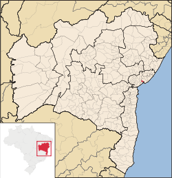
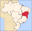
Itaparica is a city located in the Brazilian island of the same name in the state of Bahia.
References
External links
- (English) (French) (Dutch) Visit Itaparica & Bahia in your language
This article is issued from Wikipedia. The text is available under the Creative Commons Attribution/Share Alike; additional terms may apply for the media files.
