Ipiguá
From Wikipedia, the free encyclopedia
| Ipiguá | ||
|---|---|---|
| Municipality | ||
| The Municipality of Ipiguá | ||
| ||
 | ||
| Coordinates: 20°39′25″S 49°23′13″W / 20.65694°S 49.38694°WCoordinates: 20°39′25″S 49°23′13″W / 20.65694°S 49.38694°W | ||
| Country |
| |
| Region | Southeast | |
| State |
| |
| Mesoregion | São José do Rio Preto | |
| Government | ||
| • Mayor | Efraim Garcia Lopes | |
| Area | ||
| • Total | 136.8 km2 (52.8 sq mi) | |
| Elevation | 508 m (1,667 ft) | |
| Population (2010/IBGE) | ||
| • Total | 4,463 | |
| • Density | 32.6/km2 (84/sq mi) | |
| Time zone | UTC-3 (UTC-3) | |
| • Summer (DST) | UTC-2 (UTC-2) | |
| Postal Code | 15108-000 | |
| Area code(s) | +55 17 | |
| Website | Prefecture of Ipiguá | |

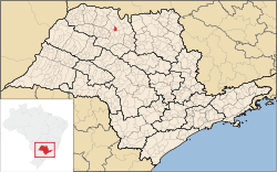
Ipiguá is a city in the state of São Paulo, Brazil. The population is of 4,463 inhabitants (IBGE/2010) in an area of 134.44 km². The name comes from the Tupi language. Ipiguá is located 20 km from São José do Rio Preto.
The city belongs to the Microregion of São José do Rio Preto.
This article is issued from Wikipedia. The text is available under the Creative Commons Attribution/Share Alike; additional terms may apply for the media files.