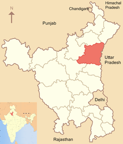
Indri, India
| Indri | |
|---|---|
| city | |
 Indri | |
| Coordinates: 29°53′N 77°04′E / 29.88°N 77.07°ECoordinates: 29°53′N 77°04′E / 29.88°N 77.07°E | |
| Country |
|
| State | Haryana |
| District | Karnal |
| Population (2001) | |
| • Total | 14,515 |
| Languages | |
| • Official | Hindi |
| Time zone | IST (UTC+5:30) |
Indri is a city and a municipal committee in Karnal district in the Indian state of Haryana. Indri is situated on state highway #7 . From an archaeological point of view, Indri might have some significance, As there are a lot of old structures present in and around it. There is an old fort which is totally under sand now ( Area around 7-8 acre and height is around 25 meters ).Old fort walls can be found 2-6 meters below the ground level at some other places as well.
Demographics
As of 2001 India census,[1] Indri had a population of 14,515. Males constitute 53% of the population and females 47%. Indri has an average literacy rate of 63%, higher than the national average of 59.5%: male literacy is 68%, and female literacy is 58%. In Indri, 15% of the population is under 6 years of age.
Agriculture
The main source of income is agriculture. Farmers of Indri and surrounding areas produce wheat, rice, sugarcane and vegetables, which supply local mills and markets. Best Food International Pvt. Ltd.(Rice Export Mill) India's largest manufacturer and exporter is located in Indri.
References
- ↑ "Census of India 2001: Data from the 2001 Census, including cities, villages and towns (Provisional)". Census Commission of India. Archived from the original on 2004-06-16. Retrieved 2008-11-01.
| ||||||||||||||||
