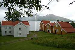
Ibestad
| Ibestad kommune Ivvárstáđiid suohkan | |||
|---|---|---|---|
| Municipality | |||
 | |||
| |||
 | |||
| Coordinates: 68°49′46″N 17°14′45″E / 68.82944°N 17.24583°ECoordinates: 68°49′46″N 17°14′45″E / 68.82944°N 17.24583°E | |||
| Country | Norway | ||
| County | Troms | ||
| District | Hålogaland | ||
| Administrative centre | Hamnvik | ||
| Government | |||
| • Mayor (2011) | Dag Brustind (H) | ||
| Area | |||
| • Total | 241.27 km2 (93.15 sq mi) | ||
| • Land | 234.37 km2 (90.49 sq mi) | ||
| • Water | 6.90 km2 (2.66 sq mi) | ||
| Area rank | 310 in Norway | ||
| Population (2012) | |||
| • Total | 1,410 | ||
| • Rank | 357 in Norway | ||
| • Density | 6.0/km2 (16/sq mi) | ||
| • Change (10 years) | -17.8 % | ||
| Demonym | Ibestadværing[1] | ||
| Time zone | CET (UTC+1) | ||
| • Summer (DST) | CEST (UTC+2) | ||
| ISO 3166 code | NO-1917 | ||
| Official language form | Bokmål | ||
| Website | www.ibestad.kommune.no | ||
|
| |||
Ibestad (Northern Sami: Ivvárstádik) is a municipality in Troms county, Norway. It is part of the traditional region of Central Hålogaland. The administrative centre of the municipality is the village of Hamnvik. Some of the other larger villages in Ibestad include Engenes, Laupstad, Rollnes, Sørrollnes, Sørvika, and Å.
General information
The municipality of Ibestad was established on 1 January 1838 (see formannskapsdistrikt). Initially, Ibestad municipality covered a large area from the Vågsfjorden to the border with Sweden (the old Astafjord church parish). In 1854, the rural eastern half of the municipality (population: 757) was separated from Ibestad to form the new municipality of Bardu. This left Ibestad with 4,741 residents.
Then, on 1 January 1871, the northeastern part of the municipality (population: 1,384) was separated from Ibestad to form the new municipality of Salangen. This left Ibestad with 4,301 inhabitants. On 1 January 1907, the easternmost area of Ibestad (population: 1,536) became the separate municipality of Lavangen. Ibestad had 5,709 residents remaining after the split.
In 1926, the municipality of Ibestad was divided into 4 separate municipalities: Andørja, Astafjord, Gratangen, and (a much smaller) Ibestad. The new municipality of Ibestad had 1,768 inhabitants. On 1 January 1964, a merger took place between the municipalities of Andørja and Ibestad, along with the part of Skånland located on the island of Rolla, creating a new municipality of Ibestad with 3,294 residents.[2]
Name
The municipality (originally the parish) is named after the old Ibestad farm (Old Norse: Ívarsstaðir), since the first church (Ibestad Church) was built there. The first element is the genitive case of the male name Ívarr and the last element is staðir which means "homestead" or "farm". Prior to 1918, the name was spelled Ibbestad.[3]
Coat-of-arms
The coat-of-arms is from modern times. They were granted on 19 December 1986. The arms symbolize that one of the oldest Norwegian stone churches was built in Ibestad. It dates from around 1200. As a symbol for this church, the arms show a cross on a medieval tombstone that was found at the church in 1960.[4]
Churches
The Church of Norway has two parishes (sokn) within the municipality of Ibestad. It is part of the Trondenes deanery in the Diocese of Nord-Hålogaland.
| Parish (Sokn) | Church Name | Location of the Church | Year Built |
|---|---|---|---|
| Andørja | Andørja Church | Engenes | 1914 |
| Ibestad | Ibestad Church | Hamnvik | 1881 |
| Sørrollnes Chapel | Sørrollnes | 1976 |
Geography
The municipality encompasses the islands of Andørja and Rolla and the tiny surrounding islets. The two main islands are connected by the undersea Ibestad Tunnel. The Mjøsund Bridge connects Andørja to Salangen municipality on the mainland. There is a regular ferry connection from Sørrollnes on Rolla to the town of Harstad.
The Astafjorden forms the southeastern border of the municipality and the Vågsfjorden forms the western and northern borders. The small Mjøsundet strait forms the eastern border. The highest point in Ibestad is the 1,276-metre (4,186 ft) tall Langlitinden mountain.
Climate
| Climate data for Hamnvik | |||||||||||||
|---|---|---|---|---|---|---|---|---|---|---|---|---|---|
| Month | Jan | Feb | Mar | Apr | May | Jun | Jul | Aug | Sep | Oct | Nov | Dec | Year |
| Daily mean °C (°F) | −3.4 (25.9) |
−3.1 (26.4) |
−1.5 (29.3) |
1.6 (34.9) |
6.2 (43.2) |
10.0 (50) |
12.4 (54.3) |
11.9 (53.4) |
8.0 (46.4) |
3.9 (39) |
−0.1 (31.8) |
−2.4 (27.7) |
3.6 (38.5) |
| Precipitation mm (inches) | 89 (3.5) |
82 (3.23) |
66 (2.6) |
56 (2.2) |
42 (1.65) |
49 (1.93) |
63 (2.48) |
74 (2.91) |
99 (3.9) |
128 (5.04) |
97 (3.82) |
105 (4.13) |
950 (37.4) |
| Source: Norwegian Meteorological Institute[5] | |||||||||||||
References
- ↑ "Personnemningar til stadnamn i Noreg" (in Norwegian). Språkrådet.
- ↑ Jukvam, Dag (1999). "Historisk oversikt over endringer i kommune- og fylkesinndelingen" (in Norwegian). Statistisk sentralbyrå.
- ↑ Rygh, Oluf (1911). Norske gaardnavne: Troms amt (in Norwegian) (17 ed.). Kristiania, Norge: W. C. Fabritius & sønners bogtrikkeri. p. 40.
- ↑ Norske Kommunevåpen (1990). "Nye kommunevåbener i Norden". Retrieved 2008-12-04.
- ↑ "eKlima Web Portal". Norwegian Meteorological Institute.
External links
 Media related to Ibestad at Wikimedia Commons
 The dictionary definition of ibestad at Wiktionary
- Municipal fact sheet from Statistics Norway
 Troms travel guide from Wikivoyage
| ||||||||||

