Huapai
From Wikipedia, the free encyclopedia
| Huapai | |
|---|---|
 Huapai | |
| Coordinates: 36°46′17″S 174°32′19″E / 36.77139°S 174.53861°ECoordinates: 36°46′17″S 174°32′19″E / 36.77139°S 174.53861°E | |
| Country | New Zealand |
| Region | Auckland Region |
| District | Rodney District |
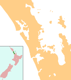
Huapai is a locality north-west of Auckland, New Zealand. State Highway 16 and the North Auckland Railway Line pass through it. Kumeu is adjacent to the east, Riverhead is to the north-east, and Waimauku to the west.[1][2]
The locality is part of the Kumeu wine growing district, with grapes first planted at Huapai by Nikola Nobilo in 1943.[3]
Education
Huapai District School is a coeducational full primary school (years 1-8), with a decile rating of 9 and a roll of 408 in 2012.[4]
Notes
- ↑ Peter Dowling (editor) (2004). Reed New Zealand Atlas. Reed Books. map 11. ISBN 0-7900-0952-8.
- ↑ Roger Smith, GeographX (2005). The Geographic Atlas of New Zealand. Robbie Burton. maps 34–35. ISBN 1-877333-20-4.
- ↑ "Nobilo History". Nobilo Wines. Archived from the original on 2008-07-19. Retrieved 2008-09-05.
- ↑ "Te Kete Ipurangi - Huapai District School". Ministry of Education.
This article is issued from Wikipedia. The text is available under the Creative Commons Attribution/Share Alike; additional terms may apply for the media files.