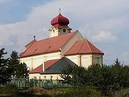
Horná Krupá
From Wikipedia, the free encyclopedia
| Horná Krupá | |
| Village | |
 | |
| Country | Slovakia |
|---|---|
| Region | Trnava |
| District | Trnava |
| Elevation | 216 m (709 ft) |
| Coordinates | 48°31′05″N 17°31′53″E / 48.51806°N 17.53139°E |
| Area | 8.65 km2 (3.34 sq mi) |
| Population | 520 (2004-12-31) |
| Density | 60 / km2 (155 / sq mi) |
| First mentioned | 1113 |
| Postal code | 919 65 |
| Area code | +421-33 |
| Car plate | TT |
  Location of Horná Krupá in Slovakia
| |
  Location of Horná Krupá in the Trnava Region
| |
| Statistics: MOŠ/MIS | |
| Website: www.hornakrupa.com | |
Horná Krupá is a village and municipality of Trnava District in the Trnava region of Slovakia.
External links
This article is issued from Wikipedia. The text is available under the Creative Commons Attribution/Share Alike; additional terms may apply for the media files.