Holt, Wiltshire
| Holt | |
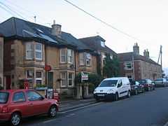 Post office in the village centre |
|
 Holt | |
| Population | 1,518 (2001 census)[1] |
|---|---|
| - London | 100 mi (160 km) |
| Civil parish | Holt |
| Unitary authority | Wiltshire |
| Ceremonial county | Wiltshire |
| Region | South West |
| Country | England |
| Sovereign state | United Kingdom |
| Post town | Trowbridge |
| Postcode district | BA14 |
| Dialling code | 01225 |
| Police | Wiltshire |
| Fire | Wiltshire |
| Ambulance | Great Western |
| EU Parliament | South West England |
| UK Parliament | Chippenham |
Holt is a village and civil parish 2 miles (3.2 km) northeast of Bradford on Avon in Wiltshire, England.
Parish church
The Church of England parish church of Saint Katharine was rebuilt in 1891 to designs by the Gothic Revival architect C.E. Ponting of Marlborough.[2] The Decorated Gothic south porch and Perpendicular Gothic west tower survive from the earlier mediaeval parish church.[2]
Economy
The settlement was served by Holt Junction railway station of Great Western Railway Devizes Branch Line, until its closure in 1966.
The North Wiltshire Dairy Company had a creamery with private siding access to the station. Taken over by Nestlé, milk trains were dispatched via the GWR and latterly British Railways to London on a daily basis. Milk trains stopped on closure of the line.[3]
Amenities
Holt has a village shop. two public houses, The Tollgate Inn and The Old Ham Tree in addition to a Post Office. Local children attend Holt Voluntary Controlled Primary School. The village also boasts a bowls club, which is one of the top clubs in Wiltshire. Holt Football Club has the honour of being the oldest club in Wiltshire having been established in 1864.
There is a cricket field under construction in the field behind The Tollgate Inn. The Glove Factory development contains shops, studios and cafe.
The Courts Garden
In the centre of the Village, is the Courts Gardens, owned by the National Trust, a fine example of the early 20th Century English garden style, with an Arboretum, working vegetable garden and orchard.
References
- ↑ "Area selected: West Wiltshire (Non-Metropolitan District)". Neighbourhood Statistics: Full Dataset View. Office for National Statistics. Retrieved 15 June 2010.
- ↑ 2.0 2.1 Pevsner & Cherry, 1975, page 272
- ↑ "Gillespies Report". Wiltshire County Council. Retrieved 2012-01-25.
Sources
- Pevsner, Nikolaus; Cherry, Bridget (revision) (1975). The Buildings of England: Wiltshire. Harmondsworth: Penguin Books. pp. 272–273. ISBN 0 14 0710.26 4 Check
|isbn=value (help).