Hochgall
From Wikipedia, the free encyclopedia
| Hochgall | |
|---|---|
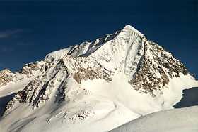
 Hochgall from the west. The high (northeast) ridge on the left forms the border with Austria. | |
| Elevation | 3,436 m (11,273 ft) |
| Prominence | 1,148 m (3,766 ft) |
| Location | |
 Hochgall | |
| Location | South Tyrol, Italy |
| Range | Rieserferner group |
| Coordinates | 46°54′45″N 12°08′30″E / 46.91250°N 12.14167°ECoordinates: 46°54′45″N 12°08′30″E / 46.91250°N 12.14167°E |
| Climbing | |
| First ascent | In 1854 the land surveyor Hermann van Acken and helpers from Defereggen reached a sub-peak on the NE Ridge. On 3 August 1868 Karl Hofmann and V. Kaltdorff with guides Georg Weis und Hansl Oberarzbacher reached the main summit over the west face. |
The Hochgall is a mountain of the Rieserferner group in South Tyrol, Italy.
References
- Werner Beikircher: Rieserfernergruppe (Alpine Club Guide) Bergverlag Rother, 1983. ISBN 3-7633-1227-7
External links
![]() Media related to Hochgall at Wikimedia Commons
Media related to Hochgall at Wikimedia Commons
This article is issued from Wikipedia. The text is available under the Creative Commons Attribution/Share Alike; additional terms may apply for the media files.