Hoar Oak Water
From Wikipedia, the free encyclopedia
| Hoar Oak Water | |
| River | |
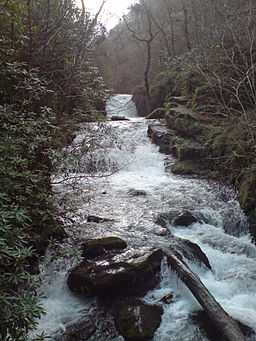
 The Hoar Oak waterfalls running into Watersmeet | |
| Country | England |
|---|---|
| County | Somerset, Devon |
| Region | Exmoor |
| Source | Hoarok Hill |
| - elevation | 475 ft (145 m) |
| - coordinates | 51°10′06″N 3°48′11″W / 51.16833°N 3.80306°W |
| Mouth | East Lyn River |
| - location | Watersmeet, Devon, England |
| - coordinates | 51°13′24″N 3°47′59″W / 51.22333°N 3.79972°W |
Hoar Oak Water is a moorland tributary of the East Lyn River in Exmoor, Somerset, England.
It rises at Hoaroak Hill in the Chains geological site in and flows to Watersmeet House in Devon.[1]
References
- ↑ "Hoar Oak Water". Somerset Rivers. Retrieved 8 September 2011.
| |||||
This article is issued from Wikipedia. The text is available under the Creative Commons Attribution/Share Alike; additional terms may apply for the media files.