Hoaden
From Wikipedia, the free encyclopedia
Coordinates: 51°17′N 1°15′E / 51.29°N 1.25°E
| Hoaden | |
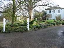
 Hoaden Court, Hoaden |
|
 Hoaden | |
| OS grid reference | TR2760 |
|---|---|
| District | Dover |
| Shire county | Kent |
| Region | South East |
| Country | England |
| Sovereign state | United Kingdom |
| Police | Kent |
| Fire | Kent |
| Ambulance | South East Coast |
| EU Parliament | South East England |
Hoaden is a hamlet situated one mile (1.6 km) to the east of Elmstone, Kent, England. Within the hamlet is Hoaden Court.
External links
![]() Media related to Hoaden at Wikimedia Commons
Media related to Hoaden at Wikimedia Commons
| |||||||||||||||||
This article is issued from Wikipedia. The text is available under the Creative Commons Attribution/Share Alike; additional terms may apply for the media files.
