High Cross, Hampshire
From Wikipedia, the free encyclopedia
Coordinates: 51°02′03″N 0°59′07″W / 51.03422°N 0.98532°W
| High Cross | |
 High Cross | |
| OS grid reference | SU712265 |
|---|---|
| Civil parish | Froxfield |
| District | East Hampshire |
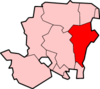
| Shire county | Hampshire |
| Region | South East |
| Country | England |
| Sovereign state | United Kingdom |
| Police | Hampshire |
| Fire | Hampshire |
| Ambulance | South Central |
| EU Parliament | South East England |
High Cross is a village in the East Hampshire district of Hampshire, England. It is 2.9 miles (4.6 km) northwest of Petersfield, north of the A272 road.
The nearest railway station is 2.7 miles (4.3 km) south of the village, at Petersfield.
External links
![]() Media related to High Cross, Hampshire at Wikimedia Commons
Media related to High Cross, Hampshire at Wikimedia Commons
This article is issued from Wikipedia. The text is available under the Creative Commons Attribution/Share Alike; additional terms may apply for the media files.