Hazlov
| Hazlov | |||
|---|---|---|---|
| Municipality and village | |||
 | |||
| |||
 | |||
| Country |
| ||
| Region | Karlovy Vary Region | ||
| District | Cheb District | ||
| Government | |||
| • Mayor | Miroslav Všetečka | ||
| Area | |||
| • Total | 10.77 sq mi (27.89 km2) | ||
| Elevation | 1,800 ft (550 m) | ||
| Population (2006) | |||
| • Total | 1 665 | ||
| Time zone | CET (UTC+1) | ||
| • Summer (DST) | CEST (UTC+2) | ||
Hazlov (German: Haslau) is a village and municipality in Cheb District in the Karlovy Vary Region of the Czech Republic. In 2008 it had a population of 1,665.
Geography
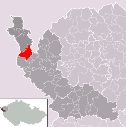
Hazlov lies 12 kilometres northwest of Cheb and 10 km southeast of Aš, at about 550 meters above sea level. Its neighbours are Lipná to the west, Táborská to the southwest, Ostroh to the south and Vojtanov to the east. To the northeast there is the German border. A stream called Hazlovský potok flows through the village.
History
Hazlov was first mentioned in 1224 as a property of the noble house of Hazlov (Haslau). Bedřich of Hazlov probably built the castle in the village. Nicholas Jur of Cheb bought Hazlov in 1401. Other owners of the village were: the Landwüst family from 1450, the Kocov family from 1579, the Dětřichov family, the Nostitz family and the Moser family. The last owners from the nobility were the Hemfeld family (until 1945).
Until the end of the 18th century Hazlov was mostly an agricultural village. From the 19th century the textile industry developed in the whole Aš-region, including Hazlov. The first textile factory was opened in 1822.
In 2008 the village had a population of 1,665. The municipality of Hazlov has six districts: Hazlov, Lipná, Polná, Skalka, Táborská and Výhledy.
| Year | 1850 | 1930 | 1947 | 1961 | 1970 | 2001 |
|---|---|---|---|---|---|---|
| Population | 1,796 | 2,922 | 999 | 1,173 | 1,168 | 1,192 |
Landmarks
Buildings
- Castle Ruins
- Feast of the Cross church (catholic)
- Cemetery of the church of St. George (from 1686)
- Evangelical church (from 1907)
Memorials and others
- World War I Memorial
- World War II Memorial
- Dr. Anton Frey Memorial
- Statue of St. John of Nepomuk
- Crucifix
- Three conciliation crosses
- Cross of Cheb
- Two chapels
Gallery
-
Ruins of castle Hazlov with Feast of the Cross church.
-

Evangelical church.
-
Hazlov railway station
References
- ↑ Progress of population of Hazlov between 1850 and 2001, according to: Obce Ašska v proměnách času, Kolektiv autorů, MÚ Aš (2005)
Notes
- This article incorporates information from the equivalent article on the Czech Wikipedia.
Coordinates: 50°09′N 12°16′E / 50.150°N 12.267°E
| Wikimedia Commons has media related to Hazlov. |


_2008-11-01.JPG)