Havnegade

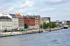
Havnegade is a waterfront promenade in Copenhagen, Denmark, which runs between Børs Brisge and the mouth of the Nyhavn canal. For most of its length, after initially passing Bank of Denmark, the street is lined with residential buildings built during the 1860s and 1870s as part of the redevelopment of the Gammelholm area. It is the only place along Copenhagen's main harbourfront where residential buildings of the period face the water, although older warehouses and other industrial buildings elsewhere have been converted into residential use. The waterfront space is currently under redevelopment.
History

The street was created when the Royal Danish Navy decommissioned its last operations in the area, which used to be a naval shipyard, and it came under urban redevelopment.[1]
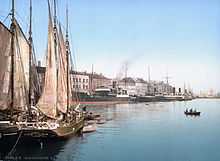
From about 1960 and until 1999, the street was a hub for tax-free ferries to Malmö on the other side of the Øresund.
Plans to transform Havnegade into a promenade were put on hold in October 2008 due to budget cuts.[2] In the spring of 2011 construction of the project finally began and it is expected to be completed in December 2011.
Buildings
- No 5 is Bank of Denmark, designed by Arne Jacobsen as a replacement for its old building in Holmens Kanal
- No. 23 was originally a Navigation School designed by Ferdinand Meldahl and built from 1863-65.[3]
- No. 29-31 was designed by Johan Daniel Herholdt for a groceer named Levin and built from 1865 to 1866.[4]
- No. 44, also known as the pencil case was originally a custom house associated with the ferries to Sweden. It is now a restaurant complex owned by Terence Conran.
-

The former Navigation School; Meldahl's building to the left, Borch's extension to the right
-

No. 44: Custom House
Havnegade today
See also
References
- ↑ "Havnegade" (in Danish). indenforvoldene.dk. Retrieved 2011-10-05.
- ↑ "PROMENADE-PLANER AFLYST". Copenhagen X. Retrieved 2009-11-25.
- ↑ "Havnegade 23-27 / Tordenskjoldsgade 34-34a" (in Danish). indenforvoldene.dk. Retrieved 2011-10-05.
- ↑ "Havnegade 29-31 / Tordenskjoldsgade 33" (in Danish). indenforvoldene.dk. Retrieved 2011-10-05.
Coordinates: 55°40′38″N 12°35′26″E / 55.67722°N 12.59056°E