Hardstoft
From Wikipedia, the free encyclopedia
Coordinates: 53°09′50″N 1°20′38″W / 53.164°N 1.344°W
| Hardstoft | |
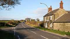
 Toll Bar Cottage, Hardstoft. |
|
 Hardstoft | |
| OS grid reference | SK439631 |
|---|---|
| Civil parish | Ault Hucknall |
| District | Bolsover |
| Shire county | Derbyshire |
| Region | East Midlands |
| Country | England |
| Sovereign state | United Kingdom |
| Post town | CHESTERFIELD |
| Postcode district | S45 |
| Police | Derbyshire |
| Fire | Derbyshire |
| Ambulance | East Midlands |
| EU Parliament | East Midlands |
| |
Hardstoft is a hamlet in Derbyshire, England. It is located four miles east of Clay Cross, on the B6039 road.
The Mexican Eagle company found small quantities of oil near Hardstoft in 1919 under encouragement from the British government.[1]
References
- ↑ The History of the British Petroleum Company, R. W. Ferrier, accessed 28 December 2008
This article is issued from Wikipedia. The text is available under the Creative Commons Attribution/Share Alike; additional terms may apply for the media files.