Hacton
From Wikipedia, the free encyclopedia
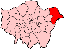
Hacton is a small dispersed settlement surrounded by the Metropolitan Green Belt, located between the suburbs of Upminster and Rainham in the London Borough of Havering in London, England. It was historically a hamlet in the ancient parish of Upminster[1] and is within the Upminster post town. The name means 'farmstead on a hook-shaped piece of land', referring to an area adjacent to the River Ingrebourne.[2]
References
- ↑ Powell, W.R. (Edr.) (1978). Upminster: Introduction and manors, A History of the County of Essex: Volume 7. Victoria County History. British History Online. Retrieved 6 February 2010.
- ↑ Mills, D. (2000). Oxford Dictionary of London Place Names. Oxford.
| |||||||||||||||||||||||||
Coordinates: 51°32′17″N 0°13′37″E / 51.538°N 0.227°E
This article is issued from Wikipedia. The text is available under the Creative Commons Attribution/Share Alike; additional terms may apply for the media files.