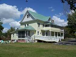
Groveland, Florida
| Groveland, Florida | |
|---|---|
| City | |
 | |
 | |
| Coordinates: 28°33′28″N 81°51′7″W / 28.55778°N 81.85194°WCoordinates: 28°33′28″N 81°51′7″W / 28.55778°N 81.85194°W | |
| Country |
|
| State |
|
| County |
|
| Area | |
| • Total | 3 sq mi (7.8 km2) |
| • Land | 2.6 sq mi (6.8 km2) |
| • Water | 0.4 sq mi (1 km2) |
| Elevation | 102 ft (31 m) |
| Population (2010) | |
| • Total | 8,729 |
| • Density | 2,900/sq mi (1,100/km2) |
| Time zone | Eastern (EST) (UTC-5) |
| • Summer (DST) | EDT (UTC-4) |
| ZIP code | 34736 |
| Area code(s) | 352 |
| FIPS code | 12-27800[1] |
| GNIS feature ID | 0283474[2] |
| Website | http://groveland-fl.gov/ |
Groveland is a city in Lake County, Florida, United States. The population was 8,729 at the 2010 census. Between 2000 and 2010, Groveland's population increased by 189%, making it the fastest growing place in Florida.[3] It is located at the intersection of State Road 19 and State Road 33/50.
Groveland is part of the Orlando–Kissimmee–Sanford Metropolitan Statistical Area.
Geography
Groveland is located at 28°33′28″N 81°51′7″W / 28.55778°N 81.85194°W (28.557853, -81.851918)[4].
According to the United States Census Bureau, the city has a total area of 3.0 square miles (7.8 km2). 2.6 square miles (6.7 km2) of it is land and 0.4 square miles (1.0 km2) of it (12.91%) is water.
Demographics
As of the census[1] of 2000, there were 7,901 people, 845 households, and 626 families residing in the city. The population density was 897.1 inhabitants per square mile (346.5/km²). There were 921 housing units at an average density of 350.1 per square mile (135.2/km²). The racial makeup of the city was 68.81% White, 22.42% African American, 0.76% Native American, 0.55% Asian, 6.27% from other races, and 1.19% from two or more races. Hispanic or Latino of any race were 14.70% of the population.
There were 845 households out of which 35.3% had children under the age of 18 living with them, 55.1% were married couples living together, 12.9% had a female householder with no husband present, and 25.8% were non-families. 21.8% of all households were made up of individuals and 9.2% had someone living alone who was 65 years of age or older. The average household size was 2.79 and the average family size was 3.23.
In the city the population was spread out with 28.3% under the age of 18, 8.9% from 18 to 24, 27.5% from 25 to 44, 22.7% from 45 to 64, and 12.6% who were 65 years of age or older. The median age was 35 years. For every 100 females there were 97.5 males. For every 100 females age 18 and over, there were 93.0 males.
The median income for a household in the city was $32,017, and the median income for a family was $37,857. Males had a median income of $27,292 versus $20,186 for females. The per capita income for the city was $15,132. About 13.9% of families and 18.8% of the population were below the poverty line, including 23.9% of those under age 18 and 22.6% of those age 65 or over.
Groveland Case
In 1949, Harry T. Moore, the executive director of the Florida NAACP, organized a campaign against the wrongful conviction of four African Americans for the rape of a white woman in Groveland. Two years later, the U.S. Supreme Court ordered a new trial. Soon afterwards, Sheriff Willis V. McCall of Lake County, Florida, shot two of the men while in his custody. One was killed and other man was seriously wounded.
Moore demanded that the sheriff be indicted for murder and requested that the Governor suspend him from office. On December 25, 1951, a bomb exploded in Moore's house, killing him and his wife, Harriette.
Some alleged that Sheriff McCall was associated with ordering this bombing. However, an extensive FBI investigation at the time and additional separate investigations have failed to produce any evidence supporting the claim of McCall's involvement.
Although members of the Ku Klux Klan were suspected of the crime, the people responsible were never brought to trial.[5]
Transportation
Osborn Airfield is located 3 miles southwest of the city. The airport is private, but is open for general aviation.
Notable people
- Art Heyman - collegiate basketball player[6]
- Jeff Demps - Running back for the Tampa Bay Buccaneers, and Olympic Silver Medalist in London 2012
Further reading
- Gilbert King (6 March 2012). Devil in the Grove: Thurgood Marshall, the Groveland Boys, and the Dawn of a New America. HarperCollins. ISBN 978-0-06-209771-2. Retrieved 3 July 2012.
References
- ↑ 1.0 1.1 "American FactFinder". United States Census Bureau. Retrieved 2008-01-31.
- ↑ "US Board on Geographic Names". United States Geological Survey. 2007-10-25. Retrieved 2008-01-31.
- ↑ 2010 Florida Places By Population Growth
- ↑ "US Gazetteer files: 2010, 2000, and 1990". United States Census Bureau. 2011-02-12. Retrieved 2011-04-23.
- ↑ PBS - Freedom Never Dies: The Story of Harry T. Moore - Florida Terror - Groveland - Introduction, 2000. Retrieved May 20, 2007
- ↑ "Art Heyman Obituary". NHObit.com. Retrieved August 29, 2012.
| Wikimedia Commons has media related to Groveland, Florida. |
| |||||||||||||||||||||||
