Groenkloof
| Groenkloof | |
|---|---|
 | |
 Groenkloof | |
| Coordinates: 25°46′30″S 28°13′05″E / 25.775108°S 28.217957°ECoordinates: 25°46′30″S 28°13′05″E / 25.775108°S 28.217957°E | |
| Country | South Africa |
| Province | Gauteng |
| Municipality | City of Tshwane |
| Main Place | Pretoria |
| Area[1] | |
| • Total | 2.83 km2 (1.09 sq mi) |
| Population (2011)[1] | |
| • Total | 4,946 |
| • Density | 1,700/km2 (4,500/sq mi) |
| Racial makeup (2011)[1] | |
| • Black African | 33.7% |
| • Coloured | 2.9% |
| • Indian/Asian | 2.4% |
| • White | 59.4% |
| • Other | 1.7% |
| First languages (2011)[1] | |
| • Afrikaans | 44.2% |
| • English | 40.5% |
| • Northern Sotho | 3.2% |
| • Tswana | 3.2% |
| • Other | 9.0% |
| Postal code (street) | 0181 |
| PO box | 0027 |
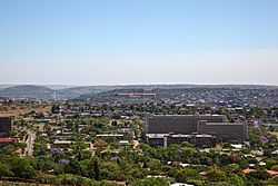
Groenkloof is a residential suburb of Pretoria, South Africa.
The famous Little Company of Mary Hospital is situated in Groenkloof as well as the Education Faculty of the University of Pretoria. The suburb is also home to various Embassies.
Groenkloof is a highly popular suburb of Pretoria due to its location. It is close to the city centre, and to the well-known Brooklyn Square and Menlyn Park shopping centres. The University of Pretoria main campus is only 3 km drive and it is a few minutes from the N14 freeway linking Pretoria and Johannesburg (via the N1).
The suburb lies between Florence Ribeiro (previously Koningin Wilhelmina) avenue to the East, George Storrar avenue to the North and Fort Klapperkop to the South. Herbert Baker- and Van Wouw- streets are some of the well-known streets in the area and home to some of the city's wealthiest residents.[citation needed]
References
- ↑ 1.0 1.1 1.2 1.3 "Sub Place Groenkloof". Census 2011.
| |||||||||||||||||
.svg.png)