Gribben Head
Gribben Head or Gribbin Head (Cornish: an Gribyn)[1] is a promontory on the south coast of Cornwall, United Kingdom. It separates St Austell Bay from the estuary of the River Fowey and is marked by a large tower used to aid navigation of ships approaching the local harbours. The nearest town is Fowey. The Western point of the headland is called Little Gribben.
Location
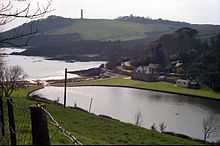
Gribben Head is the most southerly part of the parish of Fowey. To the north, and facing west across St Austell Bay is the small village of Polkerris, beyond which is the harbour at Par. To the east is Polridmouth cove and the Fowey estuary, where the town of Fowey itself is situated. Inland, to the north, is the Menabilly estate,[2] built for the Rashleigh family but later home to author Daphne du Maurier.[3]
The 75 metres (246 ft) high[4] promontory forms a part of the South Coast (Eastern) section of the Cornwall Area of Outstanding Natural Beauty.[5] The South West Coast Path passes around Gribben Head on its way from Minehead in Somerset to Poole in Dorset.[2]
Gribben Tower
The 84 feet (26 m) high square beacon tower was erected by Trinity House in 1832 to distinguish the Gribben from Dodman Point and St Anthony’s Head, and thus make navigation into Fowey and the harbours of St Austell Bay safer. It was never lighted, but is painted in broad red and white bands as a daymark.[6] [7]
References
- ↑ Place-names in the Standard Written Form (SWF) : List of place-names agreed by the MAGA Signage Panel. Cornish Language Partnership.
- ↑ 2.0 2.1 Ordnance Survey 1:25000 Explorer Map 107
- ↑ Keast, John (1987) [1950]. The Story of Fowey. Redruth: Dyllansow Truran. ISBN 1-85022-035-2.
- ↑ Mason, John (1991) [1989]. Walk the Cornish Coastal Path. Edinburgh: Bartholomew. ISBN 0-7028-0902-0.
- ↑ "Where is the Cornwall AONB?". Cornwall AONB. Cornwall AONB. Retrieved 2009-01-15.
- ↑ Rowlett, Russ (2010-05-03). "Lighthouses of Southwest England (Devon and Cornwall)". The Lighthouse Directory. University of North Carolina at Chapel Hill.
- ↑ Ward-Jackson, C. H. (1986). Ships and Shipbuilders of a Westcountry Seaport: Fowey 1786-1939. Truro: Twelveheads Press. ISBN 0-906294-11-8.
| ||||||||||||||||||||
Coordinates: 50°19′01″N 4°40′23″W / 50.31699°N 4.67310°W