Great River (Jamaica)
| Great River (Jamaica) | |
|---|---|
| Origin | 18°12′26″N 77°53′01″W / 18.207196°N 77.8835177°W |
| Mouth | 18°26′58″N 77°59′32″W / 18.449568°N 77.9922867°WCoordinates: 18°26′58″N 77°59′32″W / 18.449568°N 77.9922867°W |
| Basin countries | Jamaica |
| Length | 57 miles (92 km) |
| Source elevation | 1,400 feet (430 m) |
Great River
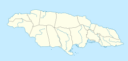
_showing_the_Great_River.png)
The Great River (Jamaica) is one of Jamaica's major rivers,[1] and forms the boundary of the parish of St James with Westmoreland and Hanover.[2]
Course
The Great River rises at about 1,400 feet (430 m) just north of the small village of Pisgah in the north west corner of St Elizabeth.[2] From here it flows north north east for about 57 miles (92 km) (some sources say 46 miles (74 km)[1]) reaching the Caribbean Sea at Great River Bay on the island's north coast, 4.5 miles (7.2 km) west of Montego Bay.[2]
Ecology
The Great River is home to the second largest tree in the island,[citation needed] and to crawfish.
Tourism
The Great River is one of the three most popular for traditional rafting on bamboo rafts.[1] It is also used for tube[3] and zip line[citation needed] craft.
See also
References
- ↑ 1.0 1.1 1.2 "The Major Rivers in Jamaica". Kingston, Jamaica: National Library of Jamaica. Retrieved 10 February 2010.
- ↑ 2.0 2.1 2.2 UK Directorate of Overseas Surveys 1:50,000 map of Jamaica sheet D, 1959.
- ↑ ""Tubing in Jamaica"".=
- Ford, Jos C. and Finlay, A.A.C. (1908).The Handbook of Jamaica. Jamaica Government Printing Office