Grand-Rullecourt
From Wikipedia, the free encyclopedia
| Grand-Rullecourt | ||
|---|---|---|
 | ||
| ||
 Grand-Rullecourt | ||
|
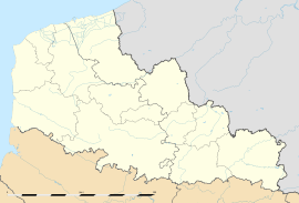
Location within Nord-Pas-de-Calais region  Grand-Rullecourt | ||
| Coordinates: 50°15′19″N 2°28′30″E / 50.2553°N 2.475°ECoordinates: 50°15′19″N 2°28′30″E / 50.2553°N 2.475°E | ||
| Country | France | |
| Region | Nord-Pas-de-Calais | |
| Department | Pas-de-Calais | |
| Arrondissement | Arras | |
| Canton | Avesnes-le-Comte | |
| Intercommunality | Deux Sources | |
| Government | ||
| • Mayor (2008–2014) | Christiane Berton | |
| Area | ||
| • Land1 | 10.71 km2 (4.14 sq mi) | |
| Population (1999) | ||
| • Population2 | 334 | |
| • Population2 Density | 31/km2 (81/sq mi) | |
| INSEE/Postal code | 62385 / 62810 | |
| Elevation |
129–172 m (423–564 ft) (avg. 140 m or 460 ft) | |
|
1 French Land Register data, which excludes lakes, ponds, glaciers > 1 km² (0.386 sq mi or 247 acres) and river estuaries. 2 Population without double counting: residents of multiple communes (e.g., students and military personnel) only counted once. | ||
Grand-Rullecourt is a commune in the Pas-de-Calais department in the Nord-Pas-de-Calais region of France.
Geography
Grand-Rullecourt is a farming village situated 15 miles (24.1 km) southwest of Arras, at the junction of the D74 and D79 roads.
Population
| Year | 1962 | 1968 | 1975 | 1982 | 1990 | 1999 |
|---|---|---|---|---|---|---|
| Population | 284 | 350 | 376 | 354 | 351 | 334 |
| From the year 1962 on: No double counting—residents of multiple communes (e.g. students and military personnel) are counted only once. | ||||||
Places of interest
- The chateau, built in 1746 by Antoine-Constant de Hamel, next to the previous castle, to plans by Jean-Joseph de Watelet, mayor of the city of Arras. After the French Revolution, the chateau was sold as a national asset, (Antoine's son having died on the scaffold). His grandson bought it back but couldn't afford to keep it. It later belonged to Captain Wallerand de Hauteclocque, who was killed during World War I. After the war, the property was sold in parts. The present owners, Vicomte Patrice de Saulieu O'Toole and his wife Chantal, are currently restoring the main building.
- The church of St.Leger, dating from the seventeenth century.
- A network of underground tunnels, particularly under the church.
-

The front of the chateau
-

The rear facade
See also
References
External links
This article is issued from Wikipedia. The text is available under the Creative Commons Attribution/Share Alike; additional terms may apply for the media files.
