Grammatiko
From Wikipedia, the free encyclopedia
| Grammatiko Γραμματικό | |
|---|---|
| Location | |
 Grammatiko | |
| Coordinates | 38°12′N 23°58′E / 38.200°N 23.967°ECoordinates: 38°12′N 23°58′E / 38.200°N 23.967°E |
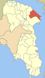
Location within the regional unit  | |
| Government | |
| Country: | Greece |
| Administrative region: | Attica |
| Regional unit: | East Attica |
| Municipality: | Marathon |
| Population statistics (as of 2011)[1] | |
| Municipal unit | |
| - Population: | 1,823 |
| - Area: | 51.674 km2 (20 sq mi) |
| - Density: | 35 /km2 (91 /sq mi) |
| Other | |
| Time zone: | EET/EEST (UTC+2/3) |
| Elevation (center): | 211 m (692 ft) |
| Postal code: | 190 07 |
| Telephone: | 22940 |
| Auto: | Z |
Grammatiko (Greek: Γραμματικό) is a village in East Attica, Greece. Since the 2011 local government reform it is part of the municipality Marathon, of which it is a municipal unit.[2]
Geography
Grammatiko is situated in the hills of the northeastern part of the Attica peninsula, 6 km from the South Euboean Gulf coast, at about 210 m elevation. It is 4 km southeast of Varnavas, 5 km north of Marathon and 32 km northeast of Athens city centre. The municipal unit Grammatiko consists of the villages Grammatiko, Agia Marina and Sesi.
Some wreckage from Helios Airways Flight 522 is reported to have fallen near Grammatiko on August 14, 2005.
Historical population
| Year | Village population | Community population |
|---|---|---|
| 1981 | - | 1,236 |
| 1991 | 1,177 | 1,498 |
| 2001 | 1,284 | 1,443 |
| 2011 | 1,432 | 1,823 |
References
- ↑ Detailed census results 2011 (Greek)
- ↑ Kallikratis law Greece Ministry of Interior (Greek)
 |
Varnavas | South Euboean Gulf |  | |
| |
||||
| ||||
| | ||||
| Marathon |
| |||||
This article is issued from Wikipedia. The text is available under the Creative Commons Attribution/Share Alike; additional terms may apply for the media files.