Grabfeld, Thuringia
From Wikipedia, the free encyclopedia
For the region rather than the political entity, see Grabfeld.
| Grabfeld | ||
|---|---|---|
| ||
 Grabfeld | ||
Location of Grabfeld within Schmalkalden-Meiningen district 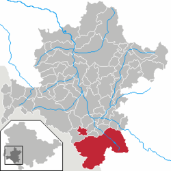 | ||
| Coordinates: 50°27′N 10°26′E / 50.450°N 10.433°ECoordinates: 50°27′N 10°26′E / 50.450°N 10.433°E | ||
| Country | Germany | |
| State | Thuringia | |
| District | Schmalkalden-Meiningen | |
| Subdivisions | 11 | |
| Area | ||
| • Total | 116.74 km2 (45.07 sq mi) | |
| Elevation | 340-370 m (−870 ft) | |
| Population (2012-12-31)[1] | ||
| • Total | 5,503 | |
| • Density | 47/km2 (120/sq mi) | |
| Time zone | CET/CEST (UTC+1/+2) | |
| Postal codes | 98631 | |
| Dialling codes | 036944, 036947 | |
| Vehicle registration | SM | |
| Website | www.grabfeld.de | |


Villages within Grabfeld
Grabfeld is a municipality in the district Schmalkalden-Meiningen, in Thuringia, Germany.
Grabfeld was established as a municipality on December 1, 2007 by combining the former municipalities of Behrungen, Berkach, Bibra, Exdorf, Jüchsen, Nordheim, Queienfeld, Rentwertshausen, Schwickershausen and Wolfmannshausen, replacing the former Verwaltungsgemeinschaft of the same name.
References
- ↑ "Bevölkerung der Gemeinden, erfüllenden Gemeinden und Verwaltungsgemeinschaften nach Geschlecht in Thüringen". Thüringer Landesamt für Statistik (in German). 13 July 2013.
This article is issued from Wikipedia. The text is available under the Creative Commons Attribution/Share Alike; additional terms may apply for the media files.