Gokyo
From Wikipedia, the free encyclopedia
| Gokyo | |
|---|---|
| Village | |
  Gokyo lake and village | |
 Gokyo | |
| Coordinates: 27°57′16″N 86°41′43″E / 27.95444°N 86.69528°ECoordinates: 27°57′16″N 86°41′43″E / 27.95444°N 86.69528°E | |
| Country |
|
| Zone | Sagarmatha Zone |
| District | Solukhumbu District |
| VDC | Khumjung |
| Time zone | Nepal Time (UTC+5:45) |
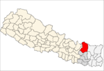
Gokyo is a small village in Solukhumbu District in the Himalayas of Nepal, at the foot of Gokyo Ri and on the eastern shore of Gokyo Cho (Dudh Pokhari). The village, barely a hamlet consisting of several huts, is located at an altitude of 4750 metres (15,583 ft),[1] making it one of the highest settlements in Nepal and in the world, but likely not permanently inhabited all year around as it is essentially a collection of huts catering to hikers. The village is best viewed on Google Earth at 27°57′16″N 86°41′43″E / 27.95444°N 86.69528°E. To the southeast is the village of Chharchung.
References
- ↑ Reynolds, Kev (23 April 2012). Everest: A Trekker's Guide: Trekking Routes in Nepal and Tibet. Cicerone Press Limited. p. 151. ISBN 978-1-84965-480-7. Retrieved 13 May 2012.
External links
This article is issued from Wikipedia. The text is available under the Creative Commons Attribution/Share Alike; additional terms may apply for the media files.
