Gochsheim
From Wikipedia, the free encyclopedia
| Gochsheim | ||
|---|---|---|
| ||
 Gochsheim | ||
Location of Gochsheim within Schweinfurt district 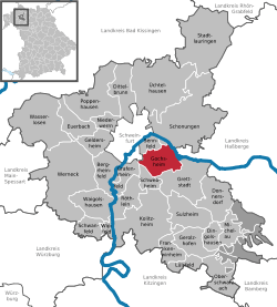 | ||
| Coordinates: 50°1′N 10°17′E / 50.017°N 10.283°ECoordinates: 50°1′N 10°17′E / 50.017°N 10.283°E | ||
| Country | Germany | |
| State | Bavaria | |
| Admin. region | Unterfranken | |
| District | Schweinfurt | |
| Subdivisions | Ortsteile Gochsheim und Weyer | |
| Government | ||
| • Mayor | Wolfgang Widmaier (CSU) | |
| Area | ||
| • Total | 21.00 km2 (8.11 sq mi) | |
| Elevation | 236 m (774 ft) | |
| Population (2012-12-31)[1] | ||
| • Total | 6,148 | |
| • Density | 290/km2 (760/sq mi) | |
| Time zone | CET/CEST (UTC+1/+2) | |
| Postal codes | 97469 | |
| Dialling codes | 09721 | |
| Vehicle registration | SW | |
| Website | www.gochsheim.de | |

Gochsheim is a municipality in the district of Schweinfurt in Bavaria, Germany. Historically, along with its neighboring village of Sennfeld, it had the rare situation of being a Reichsdorf or Imperial Village.
References
- ↑ "Fortschreibung des Bevölkerungsstandes". Bayerisches Landesamt für Statistik und Datenverarbeitung (in German). 31 December 2012.
This article is issued from Wikipedia. The text is available under the Creative Commons Attribution/Share Alike; additional terms may apply for the media files.