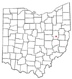
Gnadenhutten, Ohio
| Gnadenhutten, Ohio | |
|---|---|
| Village | |
 | |
| Coordinates: 40°21′39″N 81°25′54″W / 40.36083°N 81.43167°WCoordinates: 40°21′39″N 81°25′54″W / 40.36083°N 81.43167°W | |
| Country | United States |
| State | Ohio |
| County | Tuscarawas |
| Townships | Clay, Warwick, & Rush |
| Government | |
| • Mayor | David Zimmerman |
| Area[1] | |
| • Total | 0.97 sq mi (2.51 km2) |
| • Land | 0.97 sq mi (2.51 km2) |
| • Water | 0 sq mi (0 km2) |
| Elevation[2] | 837 ft (255 m) |
| Population (2010)[3] | |
| • Total | 1,288 |
| • Estimate (2012[4]) | 1,281 |
| • Density | 1,327.8/sq mi (512.7/km2) |
| Time zone | Eastern (EST) (UTC-5) |
| • Summer (DST) | EDT (UTC-4) |
| ZIP code | 44629 |
| Area code(s) | 740 |
| FIPS code | 39-30702[5] |
| GNIS feature ID | 1064736[2] |
| Website | http://gnaden.tusco.net/ |
Gnadenhutten is a village located on the Tuscarawas River in Tuscarawas County, Ohio, United States and is Ohio's oldest existing settlement. The population was 1,288 at the 2010 census.
Gnadenhutten was founded as a settlement of German Americans and Lenape Native Americans affiliated with the Moravian Church. This community remained neutral during the American Revolutionary War, but ninety-six Lenape were massacred in 1782 in the Gnadenhütten massacre by American militia in retaliation for raids carried out by other bands.
Name
Gnadenhutten is derived from the German name Gnadenhütten,[6] meaning literally "huts of grace" and figuratively "log tabernacle",.[7] The proper spelling without the umlaut ü is Gnadenhuetten.
History
See the Gnadenhutten massacre.
Geography
Gnadenhutten is located at 40°21′39″N 81°25′54″W / 40.36083°N 81.43167°W (40.360815, -81.431679).[8] According to the United States Census Bureau, the village has a total area of 0.97 square miles (2.51 km2), all of it land.[1]
Demographics
2010 census
As of the census[3] of 2010, there were 1,288 people, 509 households, and 359 families residing in the village. The population density was 1,327.8 inhabitants per square mile (512.7 /km2). There were 553 housing units at an average density of 570.1 per square mile (220.1 /km2). The racial makeup of the village was 99.1% White, 0.2% from other races, and 0.7% from two or more races. Hispanic or Latino of any race were 0.5% of the population.
There were 509 households of which 35.0% had children under the age of 18 living with them, 60.3% were married couples living together, 6.7% had a female householder with no husband present, 3.5% had a male householder with no wife present, and 29.5% were non-families. 25.7% of all households were made up of individuals and 14.2% had someone living alone who was 65 years of age or older. The average household size was 2.52 and the average family size was 3.05.
The median age in the village was 39.3 years. 25.6% of residents were under the age of 18; 6.7% were between the ages of 18 and 24; 26.2% were from 25 to 44; 24.3% were from 45 to 64; and 17.4% were 65 years of age or older. The gender makeup of the village was 49.5% male and 50.5% female.
2000 census
As of the census[5] of 2000, there were 1,280 people, 513 households, and 377 families residing in the village. The population density was 1,281.7 people per square mile (494.2/km²). There were 539 housing units at an average density of 539.7 per square mile (208.1/km²). The racial makeup of the village was 99.45% White, 0.08% African American, and 0.47% from two or more races. Hispanic or Latino of any race were 0.16% of the population.
There were 513 households out of which 30.4% had children under the age of 18 living with them, 62.8% were married couples living together, 7.6% had a female householder with no husband present, and 26.5% were non-families. 24.2% of all households were made up of individuals and 14.6% had someone living alone who was 65 years of age or older. The average household size was 2.49 and the average family size was 2.94.
In the village the population was spread out with 23.8% under the age of 18, 8.9% from 18 to 24, 26.5% from 25 to 44, 21.5% from 45 to 64, and 19.4% who were 65 years of age or older. The median age was 39 years. For every 100 females there were 86.9 males. For every 100 females age 18 and over, there were 83.8 males.
The median income for a household in the village was $34,286, and the median income for a family was $38,000. Males had a median income of $32,026 versus $20,526 for females. The per capita income for the village was $15,961. About 9.3% of families and 8.8% of the population were below the poverty line, including 12.0% of those under age 18 and 4.1% of those age 65 or over.
Notable natives and residents
- Bob Huggins - men's college basketball coach at West Virginia University
- Eldon Miller - former men's college basketball coach at Wittenberg University, Western Michigan University, Ohio State University, and the University of Northern Iowa
References
- ↑ 1.0 1.1 "US Gazetteer files 2010". United States Census Bureau. Retrieved 2013-01-06.
- ↑ 2.0 2.1 "US Board on Geographic Names". United States Geological Survey. 2007-10-25. Retrieved 2008-01-31.
- ↑ 3.0 3.1 "American FactFinder". United States Census Bureau. Retrieved 2013-01-06.
- ↑ "Population Estimates". United States Census Bureau. Retrieved 2013-06-17.
- ↑ 5.0 5.1 "American FactFinder". United States Census Bureau. Retrieved 2008-01-31.
- ↑ Gnade (the German for grace); a word with which the names of many places founded by the Moravians begin, Encyclopædia Americana, 1831
- ↑ Gannett, Henry (1905). The Origin of Certain Place Names in the United States. Govt. Print. Off. p. 139.
- ↑ "US Gazetteer files: 2010, 2000, and 1990". United States Census Bureau. 2011-02-12. Retrieved 2011-04-23.
External links
| |||||||||||||||||||||||||||||
