Glenmaggie, Victoria
From Wikipedia, the free encyclopedia
| Glenmaggie Victoria | |
|---|---|
 Lake Glenmaggie | |
 Glenmaggie | |
| Coordinates | 37°54′S 146°45′E / 37.900°S 146.750°ECoordinates: 37°54′S 146°45′E / 37.900°S 146.750°E |
| Population | 405 (2006)[1] |
| Postcode(s) | 3858 |
| Location |
|
| LGA(s) | Shire of Wellington |
| State electorate(s) | Gippsland East |
| Federal Division(s) | Gippsland |
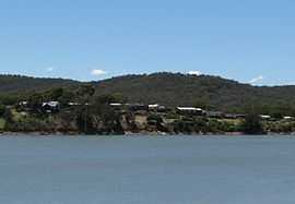
Glenmaggie is a town in Victoria, Australia, located on the shores of Lake Glenmaggie, in the Shire of Wellington. At the 2006 census, Glenmaggie and the surrounding area had a population of 405.[1]
Glenmaggie Post Office opened on 1 January 1872 and closed in 1986.[2]
Lake Glenmaggie is popular for waterskiing and boating. On 14 March 1942, a RAAF Wirraway crashed into the lake, killing the pilot.[3]
References
- ↑ 1.0 1.1 Australian Bureau of Statistics (25 October 2007). "Glenmaggie (State Suburb)". 2006 Census QuickStats. Retrieved 2007-08-04.
- ↑ Premier Postal History, Post Office List, retrieved 2008-04-11
- ↑ Dunn, Peter. "CRASH OF A WIRRAWAY INTO LAKE GLENMAGGIE, EAST GIPPSLAND, VIC ABOUT 5KM NORTH OF HEYFIELD ON 14 MARCH 1942". www.ozatwar.com. Retrieved 30 January 2013.
| Wikimedia Commons has media related to Glenmaggie, Victoria. |
| |||||
This article is issued from Wikipedia. The text is available under the Creative Commons Attribution/Share Alike; additional terms may apply for the media files.