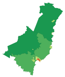
Gisborne region
| Gisborne Tai Rāwhiti | |
|---|---|
| Region of New Zealand | |
 | |
| Country |
|
| Region | Gisborne |
| Territorial authority | Gisborne District |
| Government | |
| • Mayor | Meng Foon |
| • Deputy Mayor | Rehette Stoltz |
| Area | |
| • Territorial | 8,355 km2 (3,226 sq mi) |
| Population (June 2013 estimate)[1] | |
| • Territorial | 46,700 |
| • Density | 5.6/km2 (14/sq mi) |
| • Urban | 34,800 |
| Area code(s) | 06 |
| Website | gdc.govt.nz |
The Gisborne region (Māori: 'Tai Rāwhiti') is an area of northeastern New Zealand governed by the Gisborne District Council, a unitary authority. Its largest settlement, the city also named Gisborne, is located at the northern end of Poverty Bay on the east coast.
Gisborne is named for an early Colonial Secretary William Gisborne. The council is located in the city of Gisborne.
Geography
The region is located in the northeastern corner of the North Island and is also referred to as the East Cape or East Coast or Eastland region. It is a sparsely inhabited and isolated region, with small settlements mainly clinging to small bays along the eastern shore including Tokomaru Bay and Tolaga Bay. The population of the region is 46,700 (June 2013 estimate),[1] with almost three-quarters of those living in the city of Gisborne. No other settlement has a population of over 1000. The largest other settlements are the towns of Tolaga Bay and Ruatoria, each with populations of over 800 in 2001.
Inland, the land is rough, predominantly forested, hill country. Te Urewera National Park is located in the west of the region, and the Kaingaroa Forest is located further west of that. A spine of rough ridges dominates the centre of the region, culminating in the impressive bulk of the 1620 metre Mount Hikurangi in Waiapu Valley in the region's northeast. This mountain is the fifth highest mountain in the North Island, and the highest that is not a volcano. Regarded as sacred by the Māori, there is some justification to the claims that this is the first mountain to see the sun in summer.
The region's population has higher than the national average proportion of Māori - over 50% in some areas - and still maintains strong ties to both Māori tradition and the iwi and marae structure. The predominant iwi in the region are Ngāti Porou, Rongowhakaata, Ngai Tamanuhiri, Te Aitanga a Mahaki.
| # | Towns with more than 1,000 people | 2010 | 2010 (%) | |
|---|---|---|---|---|
| 1 | Gisborne | 34,300 | 78% | |
| Total Population | 34,300 | 78% |
Government
The district council includes a mayor, 14 elected councillors, an appointed chief executive officer (CEO), 4 department managers and approximately 250 staff.
Economy
The sub-national GDP of the Gisborne region was estimated at US$1.031 billion in 2003, 1% of New Zealand's national GDP.[2]
Climate
The Māori name for the Gisborne region is Tai Rāwhiti - coast of the shining sun.[citation needed] The region is sheltered by high country to the west and has a dry, sunny climate. It has a yearly average of 2,200 sunshine hours. The annual rainfall varies from about 1000mm near the coast to over 2500mm in higher inland country.
| Climate data for Gisborne | |||||||||||||
|---|---|---|---|---|---|---|---|---|---|---|---|---|---|
| Month | Jan | Feb | Mar | Apr | May | Jun | Jul | Aug | Sep | Oct | Nov | Dec | Year |
| Average high °C (°F) | 24.9 (76.8) |
24.2 (75.6) |
22.6 (72.7) |
19.9 (67.8) |
17.1 (62.8) |
14.7 (58.5) |
14.1 (57.4) |
14.9 (58.8) |
16.8 (62.2) |
19.0 (66.2) |
21.3 (70.3) |
23.3 (73.9) |
19.5 (67.1) |
| Average low °C (°F) | 13.6 (56.5) |
13.6 (56.5) |
12.2 (54) |
9.6 (49.3) |
6.9 (44.4) |
5.3 (41.5) |
4.6 (40.3) |
5.4 (41.7) |
6.8 (44.2) |
8.6 (47.5) |
10.5 (50.9) |
12.3 (54.1) |
9.1 (48.4) |
| Precipitation mm (inches) | 54 (2.13) |
78 (3.07) |
99 (3.9) |
103 (4.06) |
97 (3.82) |
125 (4.92) |
119 (4.69) |
93 (3.66) |
101 (3.98) |
63 (2.48) |
65 (2.56) |
67 (2.64) |
1,050 (41.34) |
| Source: NIWA Climate Data[3] | |||||||||||||
2007 earthquake

At 8.55pm (NZDT) on 20 December 2007, the Gisborne region was hit by an earthquake of Richter Magnitude 6.8, centred in the Hikurangi Trench, 50 km southeast of Gisborne at a depth of 40 km.[4] Intensities of 7 - 8 were experienced, with three buildings substantially collapsed in the CBD and others experiencing some structural damage. One death was reported (a heart attack of an elderly woman, sustained during the quake) plus minor injuries.[5]
See also
References
- ↑ 1.0 1.1 "Subnational Population Estimates: At 30 June 2013 (provisional)". Statistics New Zealand. 22 October 2013. Retrieved 4 November 2013. Also "Infoshare; Group: Population Estimates - DPE; Table: Estimated Resident Population for Urban Areas, at 30 June (1996+) (Annual-Jun)". Statistics New Zealand. 19 November 2013. Retrieved 28 November 2013.
- ↑ "Regional Gross Domestic Product". Statistics New Zealand. 2007. Retrieved 18 February 2010.
- ↑ "Climate Data". NIWA. Retrieved 25 February 2009.
- ↑ GeoNet – New Zealand Earthquake Report - Dec 20 2007 at 8:55 pm (NZDT)
- ↑ Binning, Elizabeth (21 December 2007). "Quake damage extensive as massive clean-up begins". The New Zealand Herald. NZPA. Retrieved 1 October 2011.
External links
| Wikimedia Commons has media related to Gisborne Region. |
| ||||||||||||||
| |||||||||||||||||||||||||
Coordinates: 38°39′S 178°00′E / 38.650°S 178.000°E