Gharaunda
| Gharaunda | |
|---|---|
| city | |
 Gharaunda | |
| Coordinates: 29°32′N 76°58′E / 29.54°N 76.97°ECoordinates: 29°32′N 76°58′E / 29.54°N 76.97°E | |
| Country |
|
| State | Haryana |
| District | Karnal |
| Elevation | 213 m (699 ft) |
| Population (2001) | |
| • Total | 30,179 |
| Languages | |
| • Official | Hindi |
| Time zone | IST (UTC+5:30) |
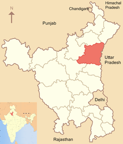
Gharaunda is a city and a municipal committee in Karnal district in the state of Haryana, India. It is situated at a distance of sixty-five miles to the northwest of New Delhi. It is eleven miles from Karnal, the district headquarters. The Amritsar-Delhi main broad-gauge railway line passes through the town.
Geography
Gharaunda is located at 29°32′N 76°58′E / 29.54°N 76.97°E.[1] It has an average elevation of 213 metres (698 feet). The municipal area of the town is 4.37 km² which does not include the existing and proposed area to be developed by Haryana Urban Development Authority under any town and country planning scheme.
Demographics
As of 2001 India census,[2] Gharaunda had a population of 30,179. Males constitute 54% of the population and females 46%. Gharaunda has an average literacy rate of 67%, higher than the national average of 59.5%: male literacy is 74%, and female literacy is 59%. In Gharaunda, 14% of the population is under 6 years of age. The main community of gharaunda is Rajput.Thay a big population nearby gharaunda.
References
- ↑ Falling Rain Genomics, Inc – Gharaunda
- ↑ "Census of India 2001: Data from the 2001 Census, including cities, villages and towns (Provisional)". Census Commission of India. Archived from the original on 2004-06-16. Retrieved 2008-11-01.
| ||||||||||||||||
