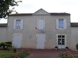
Genac
From Wikipedia, the free encyclopedia
| Genac | |
|---|---|
 | |
 Genac | |
|
Location within Poitou-Charentes region  Genac | |
| Coordinates: 45°47′59″N 0°01′35″E / 45.7997°N 0.0264°ECoordinates: 45°47′59″N 0°01′35″E / 45.7997°N 0.0264°E | |
| Country | France |
| Region | Poitou-Charentes |
| Department | Charente |
| Arrondissement | Cognac |
| Canton | Rouillac |
| Intercommunality | Rouillacais |
| Government | |
| • Mayor (2008–2014) | Franc Pinaud |
| Area | |
| • Land1 | 25.84 km2 (9.98 sq mi) |
| Population (2008) | |
| • Population2 | 668 |
| • Population2 Density | 26/km2 (67/sq mi) |
| INSEE/Postal code | 16148 / 16170 |
| Elevation |
44–157 m (144–515 ft) (avg. 70 m or 230 ft) |
|
1 French Land Register data, which excludes lakes, ponds, glaciers > 1 km² (0.386 sq mi or 247 acres) and river estuaries. 2 Population without double counting: residents of multiple communes (e.g., students and military personnel) only counted once. | |
Genac is a commune in the Charente department in southwestern France.
Population
| Historical population | ||
|---|---|---|
| Year | Pop. | ±% |
| 1793 | 1,538 | — |
| 1800 | 1,704 | +10.8% |
| 1806 | 1,291 | −24.2% |
| 1821 | 1,432 | +10.9% |
| 1831 | 1,503 | +5.0% |
| 1841 | 1,564 | +4.1% |
| 1846 | 1,612 | +3.1% |
| 1851 | 1,623 | +0.7% |
| 1856 | 1,568 | −3.4% |
| 1861 | 1,577 | +0.6% |
| 1866 | 1,511 | −4.2% |
| 1872 | 1,523 | +0.8% |
| 1876 | 1,508 | −1.0% |
| 1881 | 1,281 | −15.1% |
| 1886 | 1,208 | −5.7% |
| 1891 | 1,090 | −9.8% |
| 1896 | 1,056 | −3.1% |
| 1901 | 1,037 | −1.8% |
| 1906 | 971 | −6.4% |
| 1911 | 922 | −5.0% |
| 1921 | 823 | −10.7% |
| 1926 | 805 | −2.2% |
| 1931 | 767 | −4.7% |
| 1936 | 765 | −0.3% |
| 1946 | 774 | +1.2% |
| 1954 | 765 | −1.2% |
| 1962 | 708 | −7.5% |
| 1968 | 685 | −3.2% |
| 1975 | 686 | +0.1% |
| 1982 | 678 | −1.2% |
| 1990 | 761 | +12.2% |
| 1999 | 687 | −9.7% |
| 2008 | 668 | −2.8% |
See also
References
External links
| Wikimedia Commons has media related to Genac. |
This article is issued from Wikipedia. The text is available under the Creative Commons Attribution/Share Alike; additional terms may apply for the media files.